
COLD FRIDAY: Strong northwesterly flow has brought some snow squalls during the overnight hours. The winds will continue to kick around in the 10-20mph range through the morning hours as the squalls shut down. We’re watching high pressure move in to our south today which will do a few things to our weather in the next day.
First, a pocket of cold air settles in for today. We’ll see clouds breaking through morning and sunshine returning across the mid-state. Highs today will be held in the middle 30s. The stiff northwesterly breeze will break down in the afternoon. Later in the day, winds will start to shift westerly and the southwesterly as high pressure builds in. This will set the stage for a warm up. Evening plans will be chilled with temps near 30° under mainly clear skies. Overnight, southerly flow will hold temps in the middle 20s for lows.
TALE OF TWO DAYS: The weekend is split between a nice spring like feel on Saturday and a cold, cloudy at times, windy feel on Sunday.
Saturday the sun will be in full force with just a few clouds. A breeze out of the south will last through the day, helping to warm us up into the middle and upper 40s in spots! It’s a great day to get outside and enjoy life.

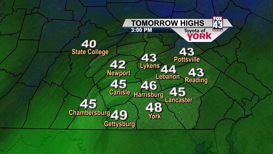
Sunday, a clipper system races across Canada. This will drag a cold front through the mid-state and quickly shift our winds back to the west and northwest. Expect added clouds, a windy day, and colder air to begin settling in. Highs will top out in the upper 30s to near 40°. A snow shower is possible through the day in spots. It’ll feel more winter like for sure.
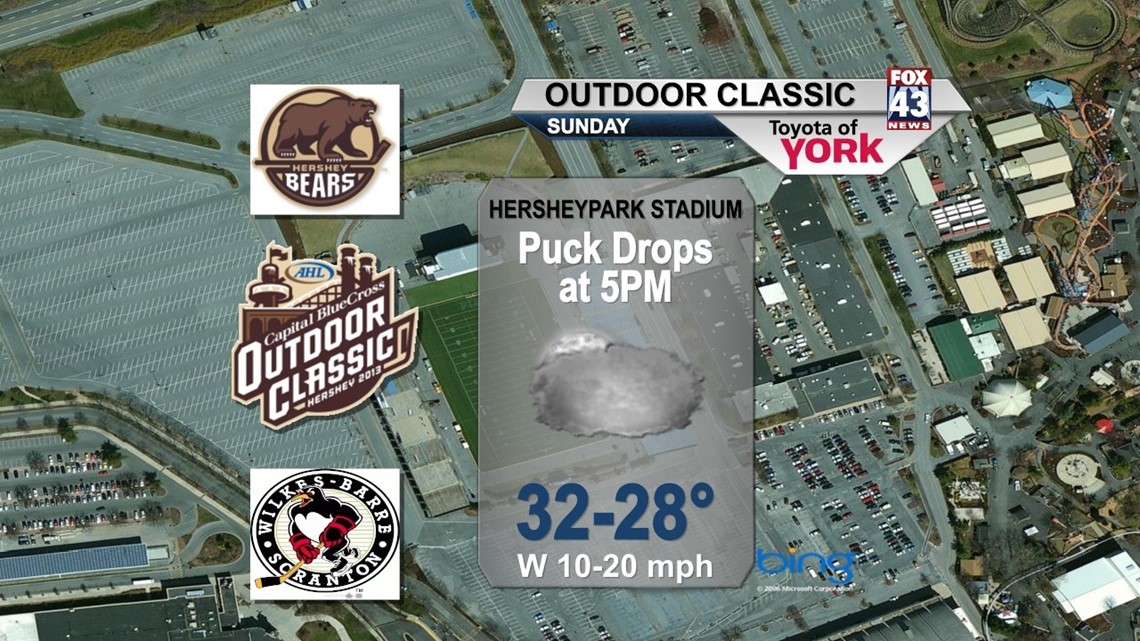
The Hershey Outdoor Classic looks cold too! Expect temperatures near freezing at 5PM Sunday with wind chills in the low 20s as gusty westerly winds pick up to the 10-20mph range. It’s mostly cloudy. Bundle up!!

COLD BLAST: Colder air settles in to start the week, but the bottom drops out Tuesday as the core of the arctic high slips into the Northeast. Expect some clouds and snow showers in a few spots Monday for Martin Luther King Jr. Day with highs near 30°. Tuesday and Wednesday will start in the middle teens and top out only in the middle 20s. Expect only slight improvement on Wednesday as temperatures return to the low 30s as another system approaches for Friday.
Stay warm this Friday! Have a great weekend folks!
– Jeff Jumper, Fox43 Morning Meteorologist
Follow me on Twitter: @JeffJumperWX
Like me on Facebook: Jeff Jumper Fox43