SHORT TERM
A quick moving clipper system has moved through tonight. Lake Effect snow showers still may linger in our northwest counties. The clouds have broken up leaving partly cloudy skies.
FRIGID STRETCH
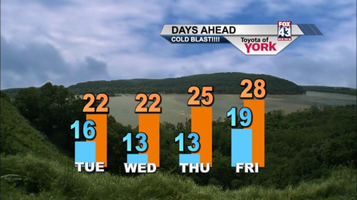
Expect temperatures to plummet tonight as much colder air rides in on gusty northwest winds. Temperatures expected to dip into the upper teens by morning but with the winds will feel like single digits.
Sunshine starts off our day but the clouds will increase into the afternoon. Highs will struggle to hit 20° to 22°. With the gusty winds, it will feel much colder. The coldest air of the season will continue into Wednesday as lows will drop in the low teens with highs only in the low 20s. Again, we’ll see more sunshine in the early part of the day but the clouds will increase into the afternoon. Another disturbance late Wednesday may bring the chance for snow flurries or light snow showers to parts of the area.
Thursday the winds start to relax and will be the best day of the next several. While calmer, it will still be cold in the mid 20s.
SNOW POTENTIAL
Models hint at the next storm system to come in towards the end of the week. It has the potential to produce some accumulating snows along with a mix of sleet, but timing and amounts are still up in the air this early in the week.
A trof will dig in behind Friday’s front for the weekend bringing another shot of cold air but it will be short lived as more moderate air arrives quickly for Late Sunday and Monday.