
FRIGID AIR: It’s not the major appliance brand, it’s Pennsylvania weather for the next few days. We are in the grip of an arctic flow through the rest of the week. The coldest air of the season is in place this morning, and to add insult to injury we have winds making it feel like single digits and negative single digits. Bundle up and have some extra coffee or hot cocoa for the ride this morning!
Today, we’re cold with highs only into the upper teens to near 20°. Clouds begin to fill the sky in the midday, with mainly cloudy skies by evening. Winds are out of the west to WNW at 10-18mph today adding to the chill in the air.
A quick moving weak system glides over us this evening into tonight. This keeps us mostly cloudy and gives us the chance for a handful of snow showers. We’re not expecting much out of these. Lows dip to the low teens with winds finally relaxing a bit.
It’s breezy again on Thursday as skies begin to clear up through the day. Temps are still cold with highs in the mid 20s.
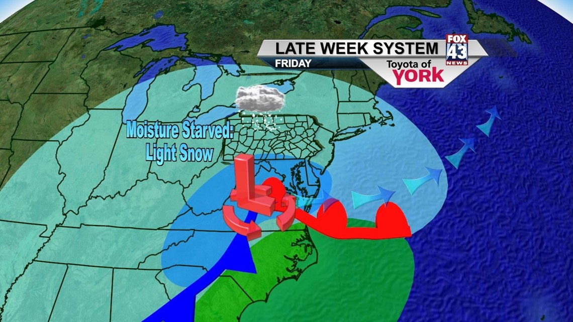
SNOW CHANCE: Friday, we’re watching a two pronged system develop that brings us the chance for some light accumulating snowfall. One system develops over TX while another one coupled with the jet stream dips south form Canada. The setup of the jet stream and arctic air means these systems will be starved for moisture until they move over the Atlantic. So now it looks like the snow will be light in nature, beginning around midday and ending late Friday evening. We’re not expecting much out of this one. More on numbers tomorrow. Highs Friday are held in the middle 20s under cloudy skies.

WEEKEND PLANS: The clouds clear eventually on Saturday with temps only in the mid to upper 20s. Sunday, we’re mostly sunny as high pressure moves in for the day. We should be close to 30 for a high.
NEXT WEEK: The jet stream lifts north and the pattern turns milder and more active. A few storm systems will race eastward bringing us the chance for snow turning to rain on Monday and purely rain on Tuesday. Temps warm back to the upper 30s to near 40° by midweek.
Here’s to a wonderful Wednesday!
– Jeff Jumper, Fox43 Morning Meteorologist
Follow me on Twitter: @JeffJumperWX
Like me on Facebook: Jeff Jumper Fox43