The storm producing light now over the area has moved offshore. Colder air will follow as high pressure builds in from Canada tomorrow. Clouds will stay with us and there could be a few flurries overngiht. Lows will drop into the low teens. With the snow pack there are likely to be areas that dip into the single digits.
SATURDAY
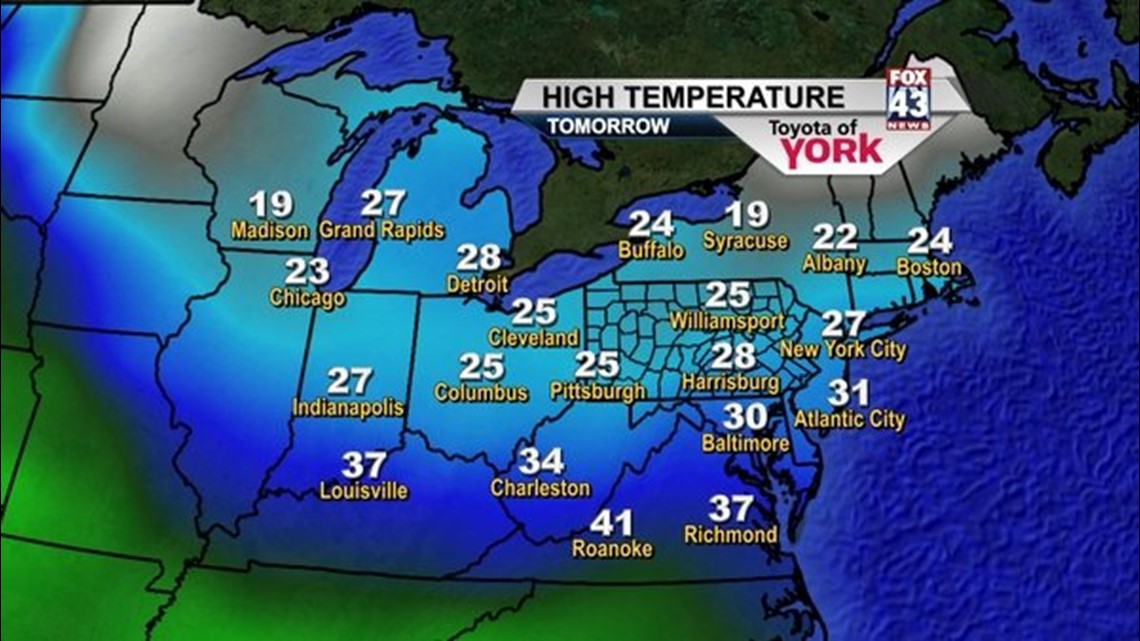
Clouds will mix with some sunshine. High temperatures will run well below average in the upper 20s but the winds will make it feel much colder. We should see the skies clearing out tomorrow night.
SUNDAY
Expect more sunshine as the high moves overhead. Winds will be much lighter and highs should reach 30 degrees.
ICY START TO THE WEEK
Monday looks to have the potential to be nasty as moisture comes in with a warm front while temperatures are below freezing. It will be warmer in the upper levels therefore, causing concern for freezing rain. Temperatures should warm through the day causing the freezing rain to mix then change to a cold rain. We’ll keep you posted over the weekend.
TURNING MILD BRIEFLY
Temperatures will start to moderate Tuesday and we will see them returning to the 40s and possibly 50s briefly. Before a cold front crosses the area Wednesday. Rain showers expected both days but the best chance will be Wednesday with the passage of the front.
BACK TO THE FREEZE
Temperatures will plummet once again to the 20s and 30s by the end of the week. Snow showes will also be possible.
Stay warm and be careful. Surfaces are slick!
~MaryEllen Pann,
Chief Meteorologist
Facebook: maryellenpannfox43
Twitter: @MaryEllenFox43