We started the day with snow, then snow, sleet and freezing rain then to all rain. Temperatures started in the 20s but slowly warmed to the low 30s as warm front pushed up through the area. No worries of ice tonight as temperatures will be well above freezing overnight.
MILDER NIGHT
With the clouds and milder air in place, overnight lows will only dip to the low 30s. Temperatures will actually hold steady or rise tonight. Fog is a concern and will cause visibilities to lower. Isolated showers or areas of drizzle is possible.
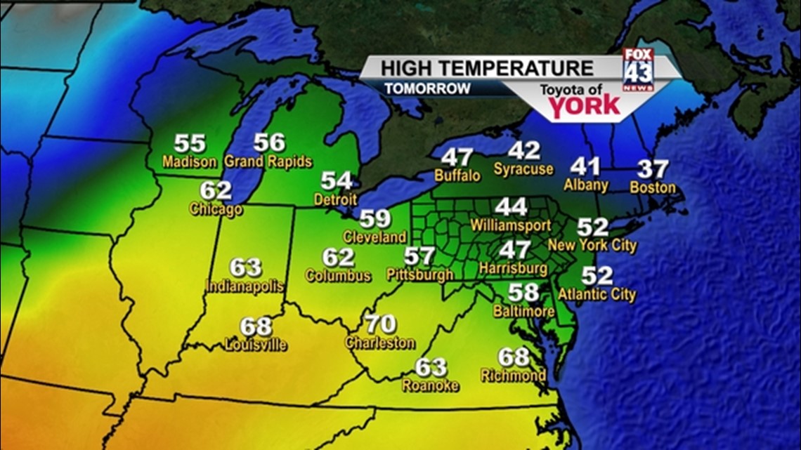
50’S!!!
The next couple of days, temperatures will get into the 50s. We’ll start out with fog tomorrow, maybe some areas of drizzle. Most of the day will be overcast and there could be a few showers develop towards midnight. A better chance of showers, maybe a few thunderstorms will be Wednesday as a strong cold front trucks through the area. Highs Tuesday will be in the low 50s with overnight lows holding in the 40s, well above average and very mild for this time of the year. Winds will pick up and become quite gusty out of the west-southwest and will boost our temperatures upward into the upper 50s to near 60 Wednesday.
COLD END TO THE WEEK
Another blast of Arctic air will funnel in behind the front plummeting temps back into the 20s and 30s for Thursday and Friday. There could be a few flurries Thursday as northwesterly winds blow across the mountains.
WEEKEND OUTLOOK
A quick moving clipper system Saturday night may produce some light snow showers. Temperatures will be at or below average for Saturday and even colder on Sunday.
~MaryEllen Pann,
Chief Meteorologist
Facebook: maryellenpannfox43
Twitter: @MaryEllenFox43