WINTER WEATHER ADVISORY has been allowed to expire for much of the area. It is in effect for Berks and Schuylkill until 5am.
Winds are picking up and are sustained out of the northwest 10 to 25 mph with gusts to 35mph. They will continue blustery overnight and into tomorrow making temperature feel quite cold. Also, seeing some light snow showers swing in from the north as they round the backside of the low which is off the coast. Most of this will be light and and should move out by early morning hours.
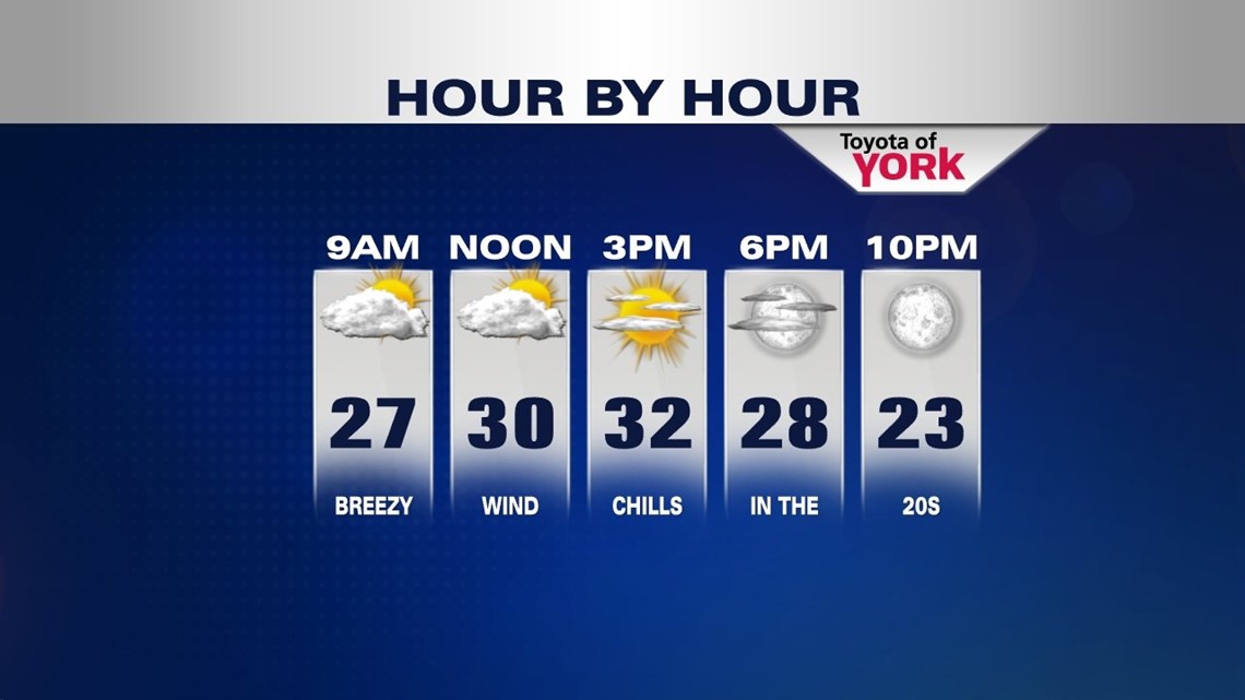
A cold start to the weekend and quite windy. We should end up with plenty of sunshine as high pressure builds into the area and the clouds decrease. Highs will be cold in the low 30s but with the brisk winds feel like the 20s.
Saturday night with clear skies and calming winds, this will allow for good radiational cooling and temperatures will plummet into the teens by morning.
Despite a cold start, we are looking at abundant sunshine for Sunday and highs climbing towards the upper 30s to near 40.
Clouds will return late Sunday as the next system moves in for Monday. Some areas may briefly experiences ome freezing drizzle but with milder temperatures expected will change over to all rain. In fact, highs could get well into the mid 40s despite the clouds and showers.
Tuesday looks to be a great day with mostly sunny skies and highs in the mid 40s.
Wednesday there are some hints of another rain snow mix and we’ll keep you posted as we get into next week.
Valentine’s Day looks pretty nice and dry with colder temperatures!
MaryEllen Pann, Chief Meteorologist
Like me on Facebook: maryellenpannfox43
Follow me on Twitter: @MaryEllenFox43