
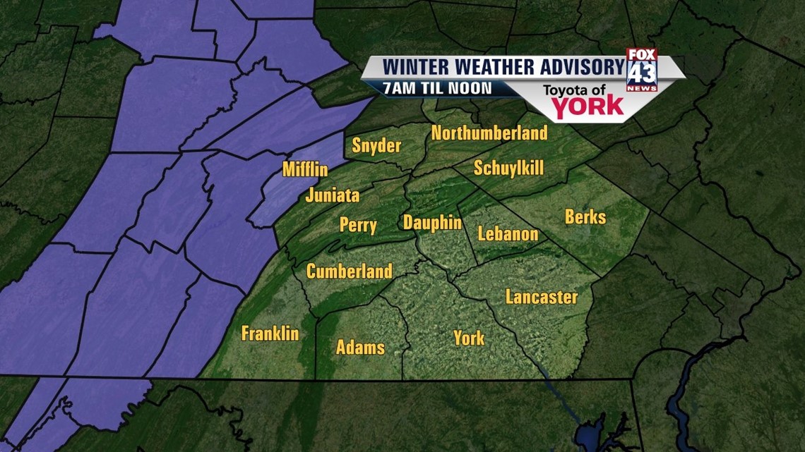
SLICK TO WET: A frontal system shifts through the state today. Expect some sloppy weather. We begin our story with subfreezing temperatures today. Some spots are below freezing and this could cause problems as the front moves east. Expect the precip to start around daybreak in our western counties. As it begins, it will likely fall as some snow or a snow to rain mix. This could fall onto surfaces at or below freezing which could result in short term icing problems.
As the precip moves east, temperatures will be rising. This will first scour out our isolated icing concern. Then, it’ll work to change the snow to rain. Expect some mixing through mid morning, and then all rain by midday. The rain will continue through the afternoon, tapering from west to east for the drive home.
Otherwise, highs today should hit the low to middle 40s. Best chances for a late turnover to rain will be in our north and western counties today. Most spots will see 0.10”-0.25” of rain today.

MID-WEEK: Clouds hold tight for Wednesday with colder air sliding in behind our system from today. Highs will be held in the low to mid 30s with a stiff westerly breeze making it feel colder. Thursday, the winds relax and the sun returns. Highs are in the upper 30s.
NEXT SYSTEM: The next system looks to hold the majority of its energy to our south. It scoots from the South to the Carolinas late Friday through Saturday. We’ll see some gradual warming and we’ll be on the north end of the precipitation shield. Yet again, we’re dancing with the potential for a rain to snow mix as temps on Friday are in the upper 30s and Saturday low 40s. Precip will hold off until late Friday and look to be sporadic on Saturday. The system pulls out to sea Saturday night and we should clear rain and snow chances by Sunday. Monday looks dry too. Highs will be in the mid to upper 40s by then.
Stay dry and watch for slick spots early today.
– Jeff Jumper, Fox43 Morning Meteorologist
Follow me on Twitter: @JeffJumperWX
Like me on Facebook: Jeff Jumper Fox43