

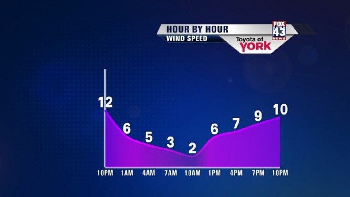
Thankful for sunshine today because it’s cold enough outside! Winds are still howling but should ease into the evening. After peaking in the low to mid 30s, temperatures will fall to the mid and upper 20s under mostly clear skies.
COLD CALMER NIGHT
Clouds will be increasing overnight but temperatures will still get cold as they drop into the low 20s. The winds shift to the north-northeast around 4 to 8mph.
A BIT OF SNOW
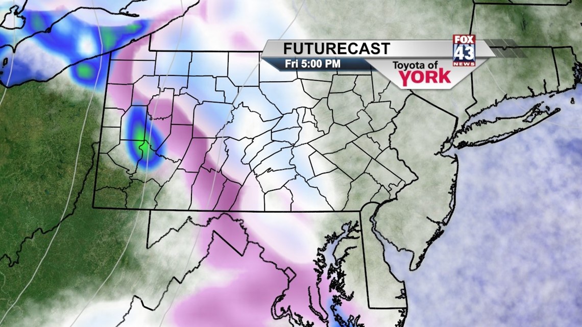
Friday morning commute will be dry and cold. A complex storm system coming in from the Ohio Valley will bring a period of light snow or sleet to he area. Clouds will thicken through the day with highs topping out in the mid to upper 30s. Light snow and sleet will start to develop in the west in the late afternoon then spread to the east. It is possible it will be enough to cause slick conditions but accumulations are expected to be on the light side.
The light wintry mix will become spotty overnight and as surface temps drop but the upper levels remain above freezing, freezing rain will be possible towards the early morning hours of Saturday.

SLOPPY START TO THE WEEKEND
Any freezing rain will change to rain early Saturday as a secondary low forms off the coast and helps to pull in milder air. Then there will be a chance for rain the rest of the afternoon. There are some indications that the best chance will be in our eastern counties. As the low pulls away, colder air will wrap in and we could possibly end with a little snow on the backside of the storm system. Highs will get to about 40 degrees.
High pressure builds in for Sunday bringing bright skies to end the weekend. Temperatures will be mild, in the low to mid 40s, as a ridge builds in the upper levels.
MILD MONDAY
Temperatures remain mild to start the week with highs in the mid 40s under increasing clouds.
PROGRESSIVE PATTERN
Another system arrives quickly for Tuesday bringing a good chance for rain with a small chance for a mix initially in the morning. Temperature profiles will be too warm for anything but rain. Colder air arrives Wednesday producing more of a mix as the upper level low swings in overhead. Thursday appears to remain unsettled with a slight chance for rain or snow. Temperatures will fall from the low 40s Tuesday to the 30s both Wednesday and Thursday.
MaryEllen Pann, Chief Meteorologist
Like me on Facebook: maryellenpannfox43
Follow me on Twitter: @MaryEllenFox43