
PRECIP BREAKDOWN: We’ve made it to Friday! However, we have a bit of a complex storm system moving into the Mid-state today. A large system in the Midwest is creeping toward the commonwealth. The system is spilling into two chunks of energy. On goes to our north and weakens and another to our south which will strengthen on Saturday. So we have two waves to break down for you.
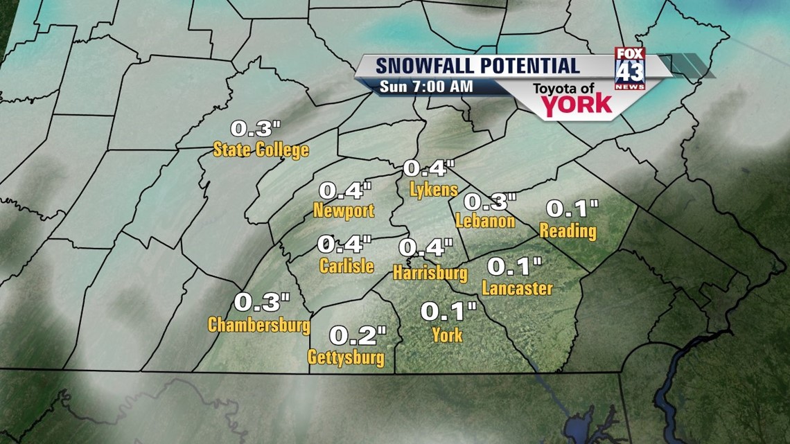
The first wave will arrive today. Moisture will be forced over a stable atmosphere, which tells us in this situation that precip will be light as it moves into the mid-state, and it will first take time to moisten things up before anything makes it to the ground. We expect a dry morning, with areas to the west seeing some light snow by midday. Light snow will shift east through the afternoon. The atmosphere will warm in the low levels. This changes snow to sleet and eventually rain later this evening and overnight. However, moisture will be dissipating so we may actually get a break overnight. The precip will be sporadic in nature today and this evening. Limited to no accumulation is anticipated. We may have to deal with freezing rain in a few spots later tonight. Be careful.

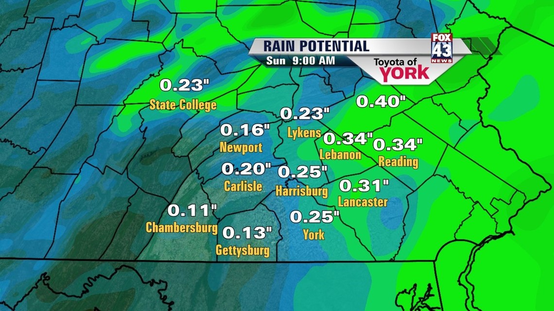
Prong two arrives from the south on Saturday. With it, the atmosphere looks warm enough now support all rain. The rain chances will be best the farther east you live. However, we expect light rain early with some moderate rain in the afternoon and evening. It all tapers early overnight as the system pulls out to sea. We could see about 0.25” of rain to the east with about 0.10” to the west.


BEYOND!: High pressure builds in Sunday with sunshine gradually returning. We’ll be seasonably mild, with temps in the low to mid 40s. We’re mostly sunny and dry Monday. Highs are a tad milder in the mid 40s. Another system will race into the Northeast for Tuesday. Lingering effects may last through the remainder of the week. Right now, the system looks like mainly rain with a mix to close things out. This is subject to change. Regardless, temps look to linger near 40 for the rest of next week. More details as soon as we know them!
Have a spectacular weekend folks!
– Jeff Jumper, Fox43 Morning Meteorologist
Follow me on Twitter: @JeffJumperWX
Like me on Facebook: Jeff Jumper Fox43