
LET’S GET WET: A large storm system will glide into the lower part of Central Pennsylvania today, bringing with it plenty of wet weather for your Tuesday. The system’s upper level energy stays with us through the rest of the week, which will keep unsettled weather in play through Friday.
So we begin with cold and dry weather this morning. Temps begin in the upper 20s with partly cloudy skies. Quickly, clouds glide in through the morning as temps make the slow and steady rise into the 30s. Then, we watch the rain move in from the south and east. We expect this to occur around midday, increasing from southwest to northeast through the early afternoon. Temps will be rising to the low and middle 40s by afternoon. However, a few spots in the north and west may not get there as quickly, especially the elevations. So, early on a handful of locations may see snow mix in with the rain briefly. Otherwise, we expect plain rain through the afternoon.

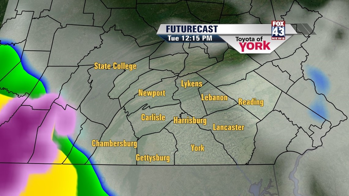


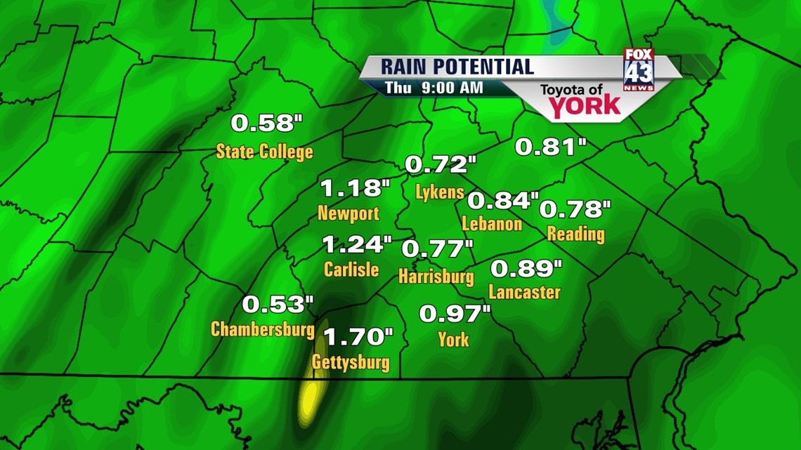
The rain continues into the evening, where it can be heavy at times here and there. Rain will continue through the overnight hours, finally tapering toward daybreak on Wednesday. Models are in pretty sound agreement that we’ll pick up at least 0.75” with some spots at or above 1”. Lows tonight dip into the upper 30s.

UNSETTLED WEEK: A slow moving upper low will be left in the wake of train from Tuesday. As mentioned above, this makes for unsettled weather. Wednesday looks to squeeze out the last of the mild weather. Expect mainly cloudy skies and highs in the upper 40s. We’ll see a few spotty rain shower or snow showers later in the day, but nothing organized. Rain/snow shower activity will continue overnight and into Thursday. Highs Thursday hit the low to mid 40s. We keep an isolated snow/rain shower in the forecast overnight Thursday too. By Friday, it looks as if the upper low pulls far enough away to remove the rain/snow chances, but it keeps the cloud cover in play. Highs are only near 40°.
WEEKEND: A pocket of colder air replaces the unsettled late week weather for the weekend. We stay mostly cloudy through Sunday. Temps will be in the upper 30s Saturday, with colder weather for Sunday. Highs will be in the middle 30s. By Monday, we should see some additional sun, with highs stuck in the mid 30s.
Have a safe Tuesday and be careful on the wet roads this afternoon!
– Jeff Jumper, Fox43 Morning Meteorologist
Follow me on Twitter: @JeffJumperWX
Like me on Facebook: Jeff Jumper Fox43