
Highs today reached 50 in many areas and it will be the warmest of the next 7 as colder air will slowly filter in each day.
THIS EVENING/OVERNIGHT
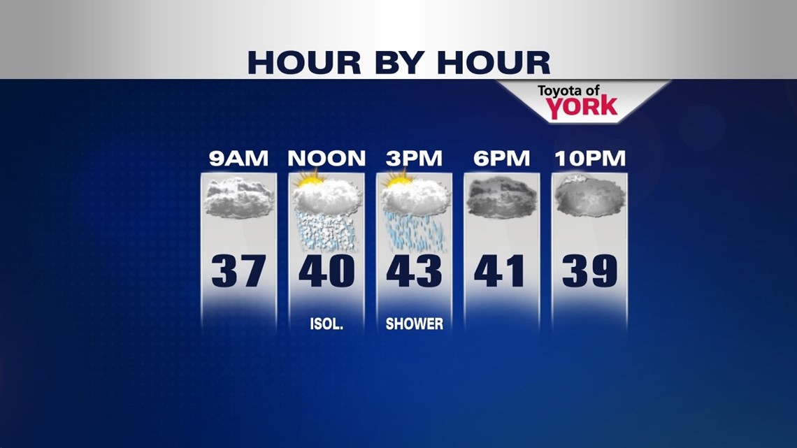
Should be a fairly mild evening with temperatures falling to the low to mid 40s and winds will diminish to around 5 to 10 mph. Lows will dip into the 30s but remain above average. Most of the morning commute should sneak by with only an isolated chance for a rain or snow shower.

CLOUDS HANG TOUGH
Low will swing through to our north tomorrow. The clouds will continue to rule as sunshine tries to show up but looking doubtful we’ll see much of it. Highs will be cooler in the low 40s. There is only an isolated shot of a rain or snow shower for the day so most of us looking at dry conditions. A bit of a breeze sets up out of the northwest.
MARCH ARRIVES LIKE A LAMB
It will be a quiet start to the month of March. A breezy and cooler air mass sets up for Friday and continues through the weekend. Winds will be northerly helping to funnel in colder air. Jet stream will be placed well to our south. Sunshine will mix in and out of the clouds.


WEEKEND CHILL
Despite more sunshine over the weekend, temperatures look to remain in the 30s for the afternoon both days.
SNOW MIDWEEK?
My favorite model the European is showing the possibility of some snow for Tuesday night into Wednesday. Don’t get excited just yet. Other data is not onboard just yet and has most of the energy diving to our south. We’ll certainly keep you posted!
MaryEllen Pann, Chief Meteorologist
Like me on Facebook: maryellenpannfox43
Follow me on Twitter: @MaryEllenFox43