
The last of the rain has moved out. Clouds will break up some but will not clear out completely. Temperatures will continue to drop into the upper 20s to around 30 by morning.
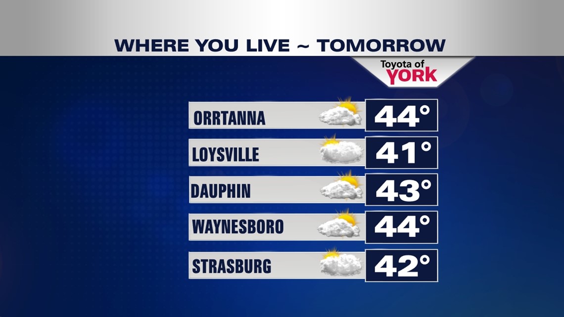
WHERE YOU LIVE FORECAST
The clouds will be persistent for tomorrow but will manage some sunshine working in and out. Winds will be breezy and highs look to remain below average in the low 40s.

Tomorrow night there will be a disturbance rotating through the upper levels of the low just off shore. It may bring some light snow flurries or light snow showers mainly in our eastern areas overnight into Friday.
A cooler, breezy Friday to end the week. Winds will be quite gusty as high pressure builds in and bumps into the low still sitting off shore. It will take a while for the low to get out and allow the high to take over for the weekend, at which time we’ll see the winds relax. Highs Friday will be still below average in the low 40s.
50s HEAD OUR WAY!
A building ridge and surface high will bring sunshine and milder temperatures for the weekend. Upper 40s to near 50 under sunny skies Saturday will be followed by more sunshine and warmer air for Sunday. Highs will reach the mid 50s by the second half of the weekend.

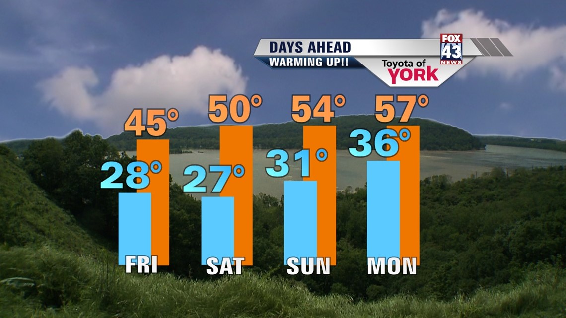
Temperatures remain well above normal for Monday as the next system slides in. Some areas may flirt with 60 by the beginning of the week. With the mild temperatures, rain is expected not snow overnight into Tuesday.
UNSETTLED PATTERN SETS UP MID WEEK
Temperatures turn cooler midweek and the weather becomes a bit unsettled once again with daily chances for rain or snow showers.
MaryEllen Pann, Chief Meteorologist
Like me on Facebook: maryellenpannfox43
Follow me on Twitter: @MaryEllenFox43