
…A WINTER STORM WARNING IS IN EFFECT THROUGH TONIGHT FOR FRANKLIN, CUMBERLAND, ADAMS, YORK, AND LANCASTER COUNTIES…
…A WINTER WEATHER ADVISORY IS IN EFFECT THROUGH TONIGHT FOR MIFFLIN, JUNIATA, PERRY, DAUPHIN, AND LEBANON COUNTIES…
HERE WE GO: Our snowiest day of the year for many is upon us. The advertised late season winter storm has moved into the region and will continue to do so through the morning hours. Not much has changed in our overall thinking, but there are a few subtle changes. We’re watching a few items closely that could make or break our snow total forecasts. We see some breaks in the radar to our south and west, and we’re also watching to see how much rain mixes in, especially to the east. Otherwise, we’re on target.
- TIMING: The snow is moving into the state and will continue to intensify as the morning progresses. We expect the heaviest snow to fall in the morning hours through early midday. Snow will continue with a few heavy pockets during the afternoon and early evening. Most snow should taper from west to east through the overnight hours.
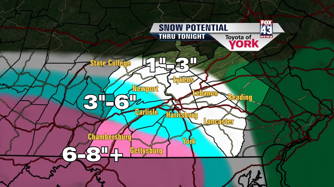
- TOTALS: Refer to the map below as a basic guide for your area. Best snow potential will be counties hugging the PA/MD border, especially west. We’ll need to monitor trends through the day.
- HAZARDS: Snow with wind will combine to reduce visibility through the morning and midday hours. Road conditions will likely deteriorate rapidly through the morning hours. Some power outages can be expected as heavy snow and winds mess around with power lines and trees.
- CONTACT US: Please send us photos, conditions, and totals via twitter using #Fox43 or to any of our Fox43 Facebook pages, as long as you can do this safely. Your reports help us get information out to others and the National Weather Service as well.

BEYOND: The storm moves out on Thursday. A few models hint at some back-building for Friday, but for now we’re keeping it dry with sunshine returning slowly. Regardless, we’re on a warming trend which lasts into the weekend. We’re talking dry and sunny weather for Saturday and Sunday. Get this; we’ll be in the 50s this weekend!
Monday into Tuesday, we’ll see our next system move into the area. This one looks to bring us rain.
– Jeff Jumper, Fox43 Morning Meteorologist
Follow me on Twitter: @JeffJumperWX
Like me on Facebook: Jeff Jumper Fox43