
MILDER FRIDAY: Beware of the Ides of March! Well maybe just be aware of a milder day! The colder pocket of air from Thursday is shoved out, replaced today by milder air and cloud cover. Today will be breezy but not as windy as yesterday. Highs should have no trouble making a run at the upper 40s. A few stray showers may develop to the north as some leftover energy dips southward. This will happen later in the day or into the evening hours so have the umbrella ready. Tonight, we’re cooling into the low to mid 30s.
ACTIVE FEW DAYS: We start the weekend on an active note. A chunk of energy rapidly dives southeast sparking a weak surface low. This will bring some snow showers mixed with a bit of rain for the start of the day Saturday. It looks like the bulk of the precip falls during the morning hours, but it will continue in spotty nature through early afternoon. Temps will struggle to get into the low 40s. Some grassy/elevated spots may see a light but slushy accumulation early, but the ground will still be pretty warm.
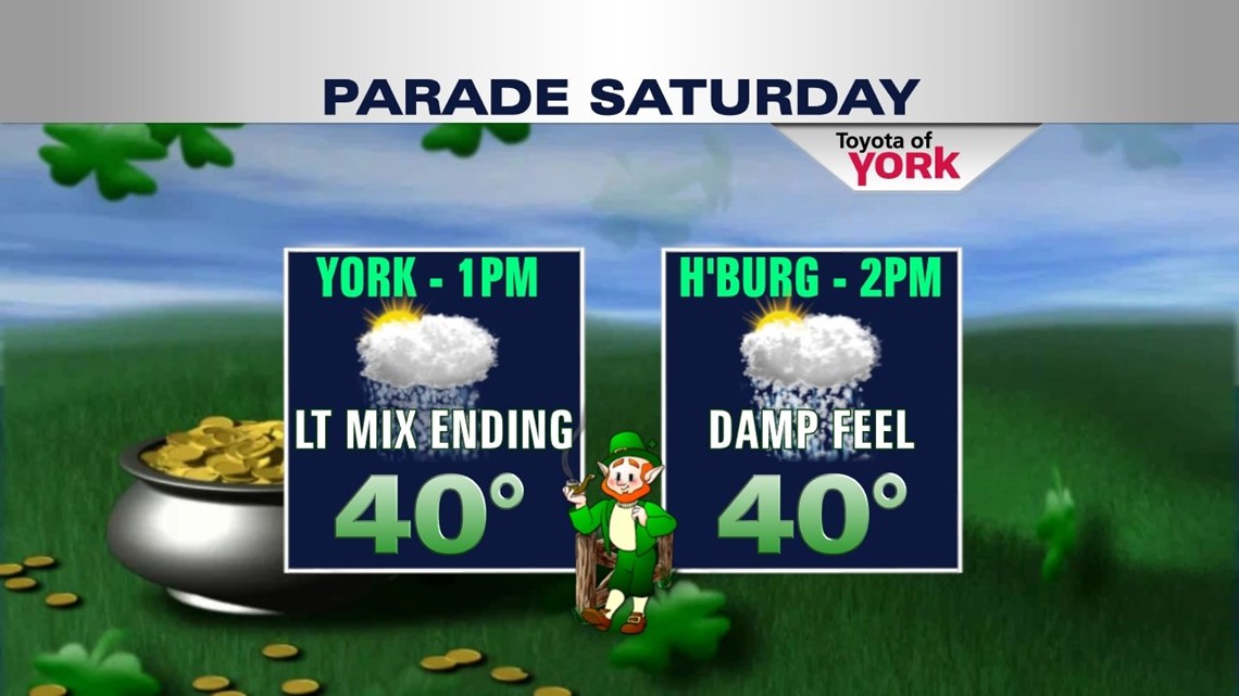
So for the parades, expect a bit of a damp, cool, and wet feel to the day. However, most of the precip should be ending as the parades begin to roll. Dress warm and be ready to stay dry. By later in the day we begin to dry out. We’re then cool and dry with clouds lingering for Sunday with highs in the mid 40s.

Late Sunday into Monday another batch of rain/snow mix arrives for morning. We’ll be generally cloudy Monday with highs in the middle 40s and rain showers during the day. Then a more potent storm system arrives for Monday night into Tuesday. This looks to be mainly rain as warmer air tries to squeeze in while the precip is falling. The heaviest falls overnight with tapering rain/snow mix or just snow by midday Monday. We’ll need to watch this closely for any changes but we look to be on the “warm” side of this system as it passes.
MID WEEK: Wednesday and Thursday look mainly dry and cool for now with highs stuck in the low 40s. By the way, spring arrives Wednesday but the spring air will have to wait a little while longer.
Have a fantastic Friday!
– Jeff Jumper, Fox43 Morning Meteorologist
Follow me on Twitter: @JeffJumperWX
Like me on Facebook: Jeff Jumper Fox43