

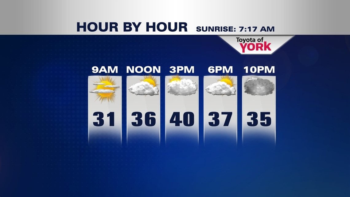
Rain and snow showers gradually come to a close across Central Pennsylvania this evening as a weak disturbance exits. This allows high pressure to start building into the area during the overnight, clearing skies late. Temperatures drop into the middle to upper 20s. Sunday brings some sunshine, but you’ll notice more clouds during the afternoon hours. Highs will be chilly, in the upper 30s to lower 40s. Cooler locations to the northwest are likely stuck in the middle 30s.
ANOTHER MIXED BAG OF PRECIP

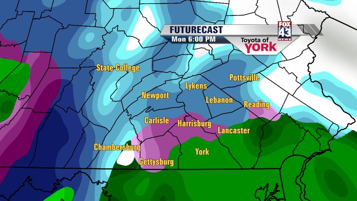
An area of low pressure forms along a stalled front to our south, and starts working its way north Sunday night into Monday morning. Precipitation enters the picture late Sunday night, starting as snow showers. As temperatures warm gradually Monday, rain begins to mix in. Some very light accumulations are possible before the rain transition, mainly on grassy surfaces. This will make the roads a bit slick and icy in spots for the Monday morning commute. Rain becomes steady overnight Monday, with a few remnant showers possible early Tuesday.
STAYING COOL, WITH CLOUDS
As we welcome spring on Wednesday, clouds hang across the area. Even Thursday looks fairly cloudy, with a few showers possible on both days. It won’t be completely gloomy; some sunshine does sneak in at times too. Friday into Saturday, the clouds finally lead way to more sunshine. Highs stay below average in the 40s through the rest of the week.
Enjoy the rest of the weekend!
-Andrea Michaels