
…A Winter Weather Advisory is in effect for our area from 8AM today through 8AM Tuesday, as some snow/sleet/freezing rain may cause isolated problems across the region….
SLOPPY MONDAY: A low pressure system developing along an old frontal boundary to our south will begin to move into the Northeast today. This system will bring us a mix of wintry weather so let’s time it out for you.
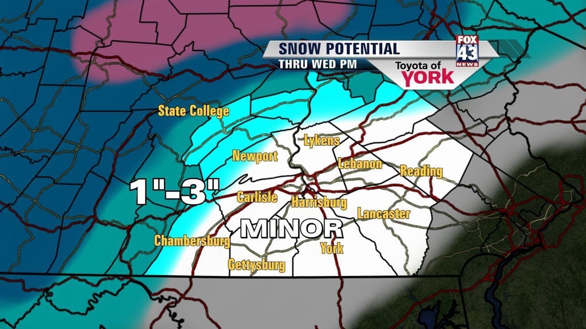
This morning, snow is moving in from the southwest. The light snow will continue through the morning hours as temperatures hover near 30°. Snow will likely accumulate on elevated surfaces and grassy areas, but most of the roadways should stay wet. Our northwest will have the best chances to see an inch or two of snow, with maybe 3” in the mountains. The models are hinting at a period of dry weather late morning into the midday hours before we pick back up.

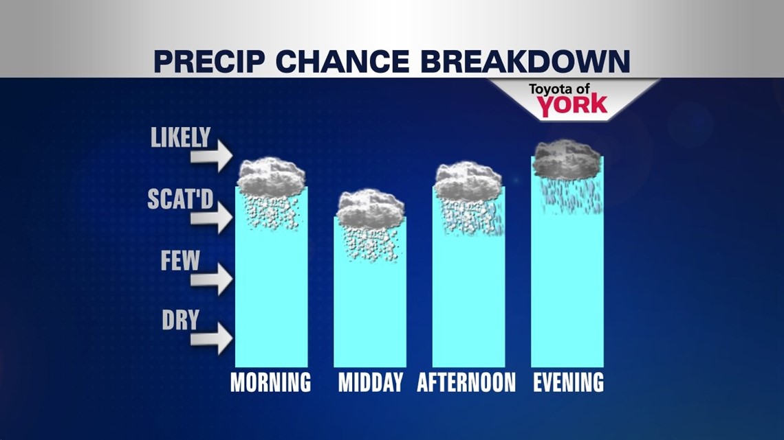
By afternoon, we’ll start to see the snow changeover to some rain as warmer air is pushed in from the south. Late afternoon should feature rain showers. By evening we should be just about all rain, with it falling heavy at times. The rain tapers to scattered activity overnight as temperatures hold steady in the middle 30s. Some pockets of near freezing temps may be found to the north, so icing is possible later today and tonight, mainly on elevated and untreated surfaces. The bulk of the rain tapers by Tuesday morning.

LESS THAN SPRING FEEL: Spring officially arrives at 7:02AM on Wednesday but the rest of the week will not feature very spring like weather. Tuesday will be milder with temps in the middle to upper 40s, but a few rain showers may linger through the afternoon. It’s also quite breezy, adding to the chill. Wednesday is colder with a high of 42° as some cooler air sits in place as an upper low spins aloft. The coldest air is here on Thursday with temps barely touching 40° and some scattered snow showers possible during the day. By Friday, we’re back to the low 40s with a bit more sunshine.
WEEKEND: It’s never too early to start looking toward the weekend! Saturday, sunshine returns and we warm into the middle 40s. We’ll see some more clouds on Sunday with highs in the upper 40s. For now, we’re dry but we’ll be watching for the development of another system.
Have a marvelous Monday!
– Jeff Jumper, Fox43 Morning Meteorologist
Follow me on Twitter: @JeffJumperWX
Like me on Facebook: Jeff Jumper Fox43