
It was a nice start with sunshine and temperatures in the 50s for the first day of April. The clouds rolled in this afternoon and a few sprinkles popped up as a cold front pushed across the area. The winds also picked up and are quite gusty out of the WNW 10 to 20 mph with gusts much higher. Going into the evening, the winds will diminish, shower threat ends and clouds will start to clear. Temperatures will fall into the upper 30s to low 40s.

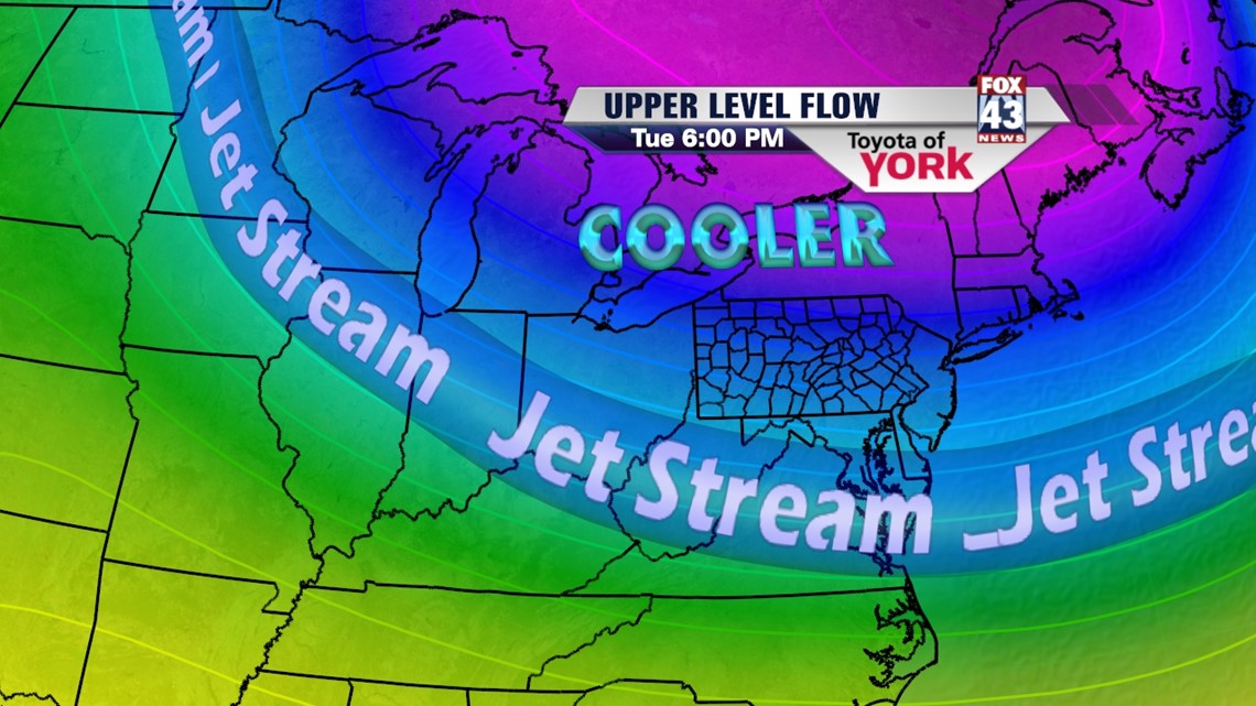
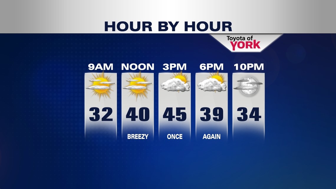
An upper level trough settles in over the northeast for a couple of days. Winds will be breezy which will help to keep drier but cooler air in place. With mostly clear skies and lighter winds, lows will dip into the mid and upper 20s. Sunshine will start off our day Tuesday with a few more clouds by afternoon and temperatures noticeably cooler in the low to mid 40s. The winds will be breezy once again.
Wednesday will be a beautiful day with plenty of sunshine but again temperatures will be running below average and stuck in the 40s. Winds may start out breezy but as high pressure builds in they will calm rather quickly by early evening.

CALM AND SUNNY THURSDAY
Trough flattens a bit and high pressure builds in at the surface allowing for plenty of bright sunshine and a calmer day across the Lower Susquehanna. Highs will top out in the mid to upper 50s.
SHOWERS OR NOT
Models are not in agreement on a southern system bringing showers for Friday. European has the low remaining far enough off the coast keeping rain away but the Canadian and GFS has rain making it into the area so we’ll keep a chance in until we see further model runs and more agreement amongst the data. Highs will be kept in the low 50s with the clouds and possible showers.

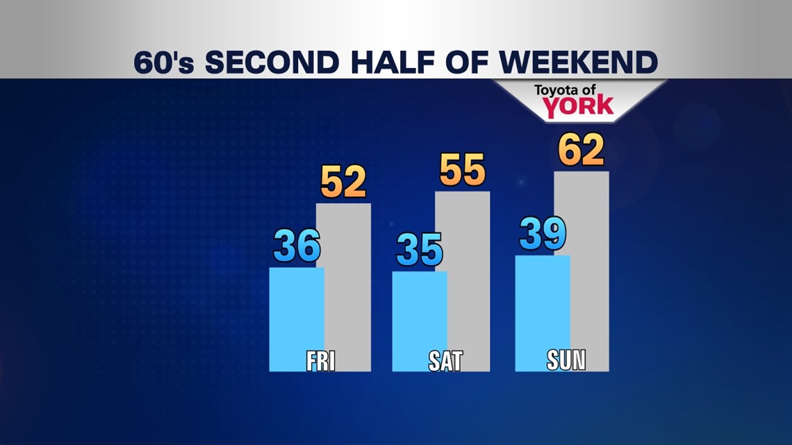
Hopefully, we can finally enjoy a nicer weather pattern going into next weekend and the second week of April. Saturday we’ll see plenty of sunshine with highs in the mid 50s. The flow will switch and we’ll tap into finally some much more seasonal like temperatures. Temperatures should be flirting with 60s and we may finally get there Sunday. Highs look to get into the low 60s under increasing clouds. There are some indications that a frontal system may bringing a few showers in late Sunday then stall across the area Monday keeping the wet weather threat around. But temperatures look to hit 60 again Monday.
MaryEllen Pann, Chief Meteorologist
Like me on Facebook: maryellenpannfox43
Follow me on Twitter: @MaryEllenFox43