
WE HIT 80 TODAY!

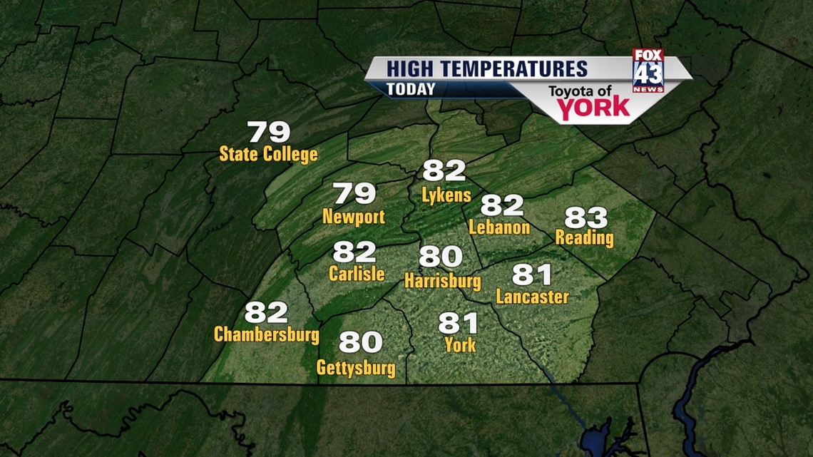
It was a hot one as temperatures had no problem climbing to 80 degrees.
Tonight it will be a toasty evening with temperatures slowly falling through the mid and upper 70s. A warm breeze continues out of the west about 5 to 15 mph. Lows will be very mild and well above average in the upper 50s to around 60.
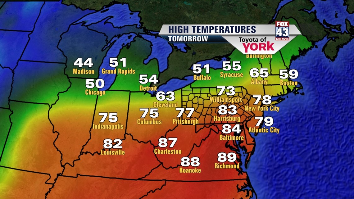
MAKING A RUN AT 80 AGAIN!
It will be another summer like day tomorrow with temperatures reaching 80 once again.


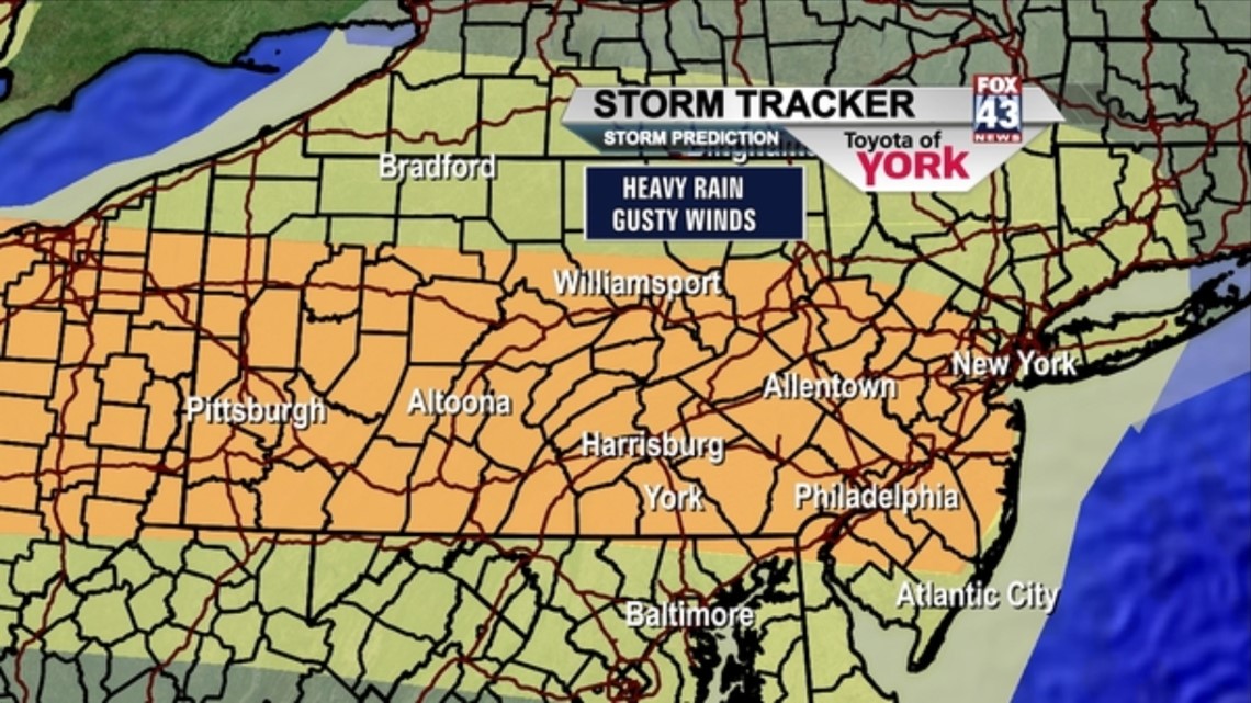
The STORM PREDICTION CENTER has us in a slight risk for severe weather but again the chance will stay closely to the front located north of Harrisburg.
BEST THREAT FOR RAIN
We don’t see the ridge breaking down until Thursday at which time a cold front drops further south across the area and brings a chance for showers and thunderstorms. Temperatures will still be warm ahead of the front but by Friday, cooler air will follow the passage of the frontal system. A good shot of rain is possible early Friday as an area of low pressure develops along the cold front.
MORE SEASONAL AND COOLER BY THE WEEKEND
Temperatures return to more seasonal averages around 60 degrees as we head into next weekend. Plenty of sunshine and dry hours to get out and catch up on spring planting or outdoor fun.
MaryEllen Pann, Chief Meteorologist
Like me on Facebook: maryellenpannfox43
Follow me on Twitter: @MaryEllenFox43