
Wow, what a fabulous evening across the Lower Susquehanna! Clear skies, comfortable temperatures and a light easterly breeze continues through the evening. Overnight, lows will drop to the low to mid 40s under starry skies.

ANOTHER BRIGHT DAY
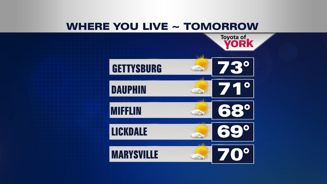
High pressure dominates for Thursday providing another sunny day. Temperatures will be a few degrees warmer into the lower 70s. Winds will remain light out of the east.

BACKDOOR COLD FRONT
Clouds will increase mixing with sunshine to end the week Friday as a backdoor cold front drops in. This means it comes in from the northeast rather than the west like they usually do. Highs will still be pleasant and seasonal in the upper 60s.
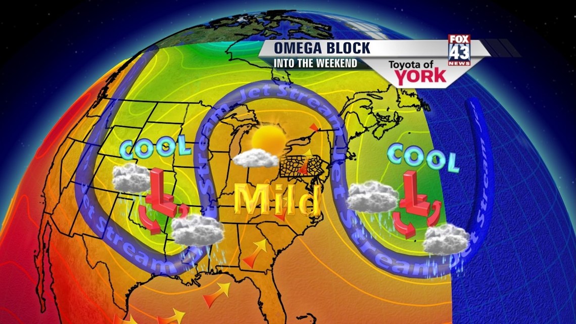
FABULOUS WEEKEND
A blocking pattern sets up over the Northeast and Mid-Atlantic. What this means is we remain dry with sunshine and temperatures close to average around 70°. It doesn’t break down until early the following week. Heading into the week, we’ll keep an eye on Monday.

RAIN CHANCES RETURN NEXT WEEK
Clouds increase for Monday but temps should still get to around 70. Tuesday and Wednesday we’ll see the threat for rain increase each day. Clouds and showers will keep temps in the 60s.
Make it a fabulous week!
MaryEllen Pann, Chief Meteorologist
Like me on Facebook: maryellenpannfox43
Follow me on Twitter: @MaryEllenFox43