


SOME EXTRA CLOUDS TODAY

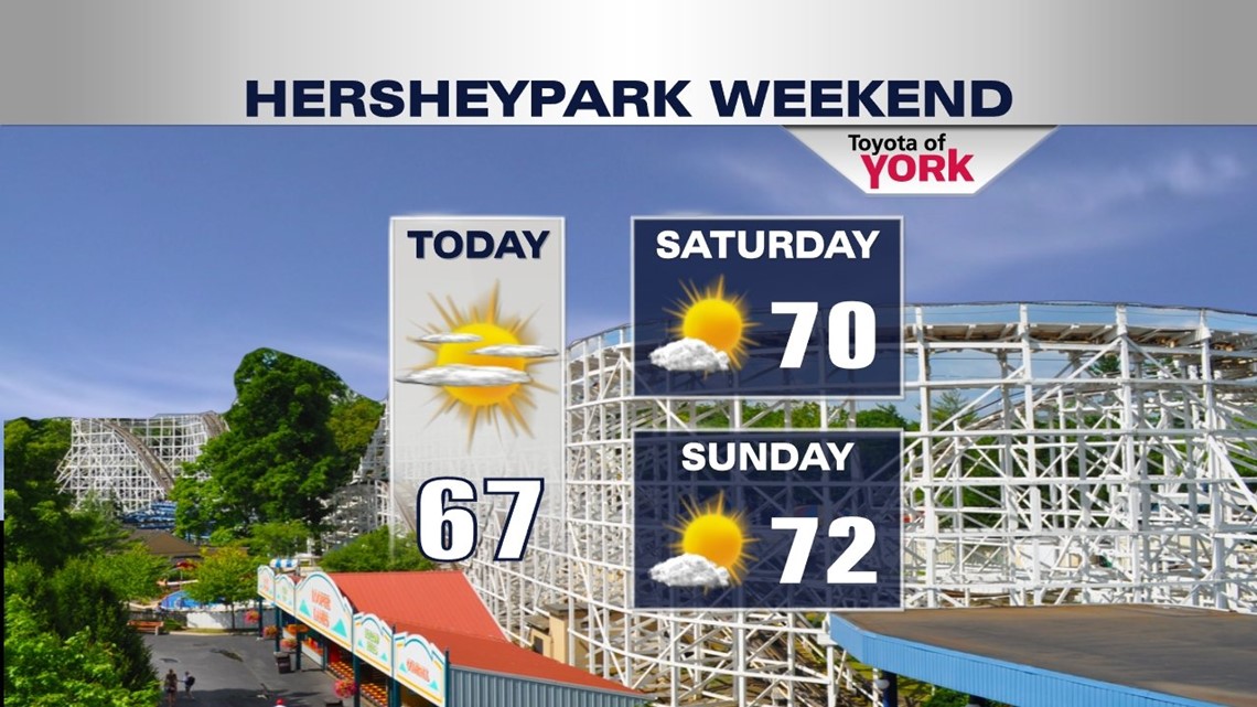
Some clouds enter the picture during the early morning hours, and a backdoor cold front sliding in from the northeast keeps them around through the rest of the morning. By afternoon, high pressure to the northeast begins building, and this chases the clouds away gradually through the afternoon. It passes through dry, meaning no showers are expected. Expect slightly cooler high temperatures, courtesy of the frontal passage. Afternoon highs are contained to the 60s throughout the Lower Susquehanna Valley. Skies become mostly clear for the overnight period, with low temperatures quite chilly in the upper 30s to lower 40s. Crank up that heat!
BACK TO SUNSHINE AND WARMTH
Temperatures bounce back to that 70 degree mark for Saturday, with plenty of sunshine. Sunday is basically a repeat, with temperatures just a little bit warmer. Monday some clouds begin to roll in, but the dry streak continues! All in all, it’s a picture perfect weekend for any type of outdoor plans. Enjoy it!
SHOWERS RETURN
A slow-moving, cut-off area of low pressure slowly drifts its way toward us through next week. By Tuesday, it’s near enough to introduce the chance for showers across the region. It’s a cloudy day, but some sunshine does poke through at times. Wednesday expect much of the same. Neither day looks like a washout despite the shower chance, meaning there will be plenty of dry time. Highs are contained to the upper 60s due to the clouds and shower chance. Thursday the low drifts off to sea, increasing sunshine and warming temperatures. Highs climb into the 70s.
Have a great weekend!
-Andrea Michaels