
Upper low continues to pull away. Weak area of high pressure builds in overnight and into early tomorrow. Showers have ended this evening. Clouds are starting to decrease but with clearing skies, fog will likely form once again especially in areas that saw rain and where the ground remains moist. Lows will drop to the low 50s.


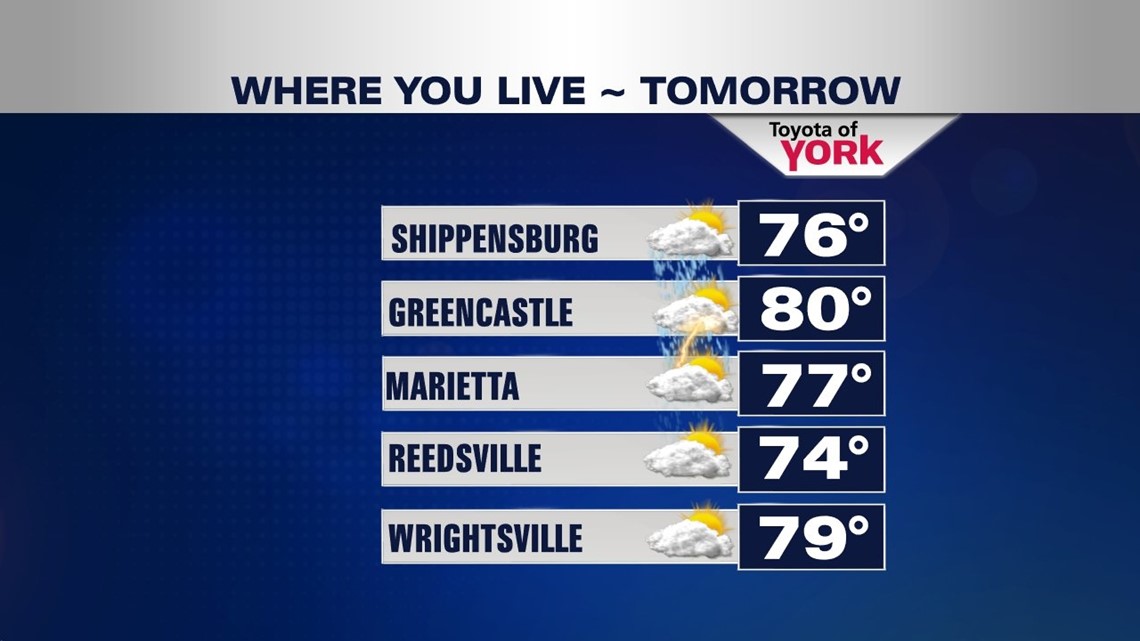
Friday, winds shift more southwesterly bringing in moisture and warmer air. A cold front comes in very late in the day towards evening and the combination of warmer temps and moisture along with the front and may trigger a few showers may trigger thunderstorms late in the day towards evening. Some of the strong could be strong with damaging winds being the main concern. Despite clouds mixing with sunshine, temperatures are expected to jump into the mid and upper 70s to maybe near 80°. The Storm Prediction Center has our western counties in a slight risk for severe weather but the entire area could be subject to strong storms. We will certainly keep you posted.


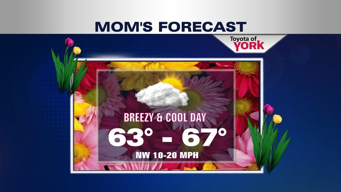
Another front comes in Saturday making for a showery start to the weekend. This one will bring another round of showers and much cooler air. We should still get to about 70° to start the weekend but by Sunday cooler but seasonal air will filter in as the front pushes out of the area. Good news is right now it looks like Mother’s Day will be mainly dry and as we go through the day; the clouds will decrease allowing for more sunshine. It will be breezy and cooler with highs in the mid 60s.
COOL COUPLE OF DAYS
The coolest air arrives early next week. We’ll enjoy plenty of sunshine as a sprawling high pressure system dominates the area. However, it will be chillier in the morning with lows in the low 40s and highs a bit below average in the low to mid 60s for the afternoon.
70s RETURN
Mid week next week we’ll warm up very quickly. Chance for showers will be slim for Wednesday but greater for Thursday.
Hope you are enjoying your week.:)
MaryEllen Pann, Chief Meteorologist
Like me on Facebook: maryellenpannfox43
Follow me on Twitter: @MaryEllenFox43