
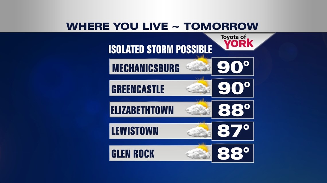
Another day many spots hitting 90°! Can we make it 3 in a row? It is looking doubtful for some. Clouds will be increasing into the afternoon and there is a chance for a shower or thunderstorm late in the day which could hold temps in the 80s especially further west.
SUMMER LIKE NIGHT
Expect clear skies overnight with very warm lows in the mid and upper 60s. Winds will be light to calm.
CAN WE GET ANOTHER?
We officially hit 90 today but with the clouds rolling in through the day and a chance for a late afternoon shower or thunderstorm, it may keep some areas from reaching 90°. Most of you will remain dry. If you have Saturday evening plans, you may run into a shower or thunderstorm, otherwise, expect a warm, muggy evening with temperatures in the upper 70s to low 80s.

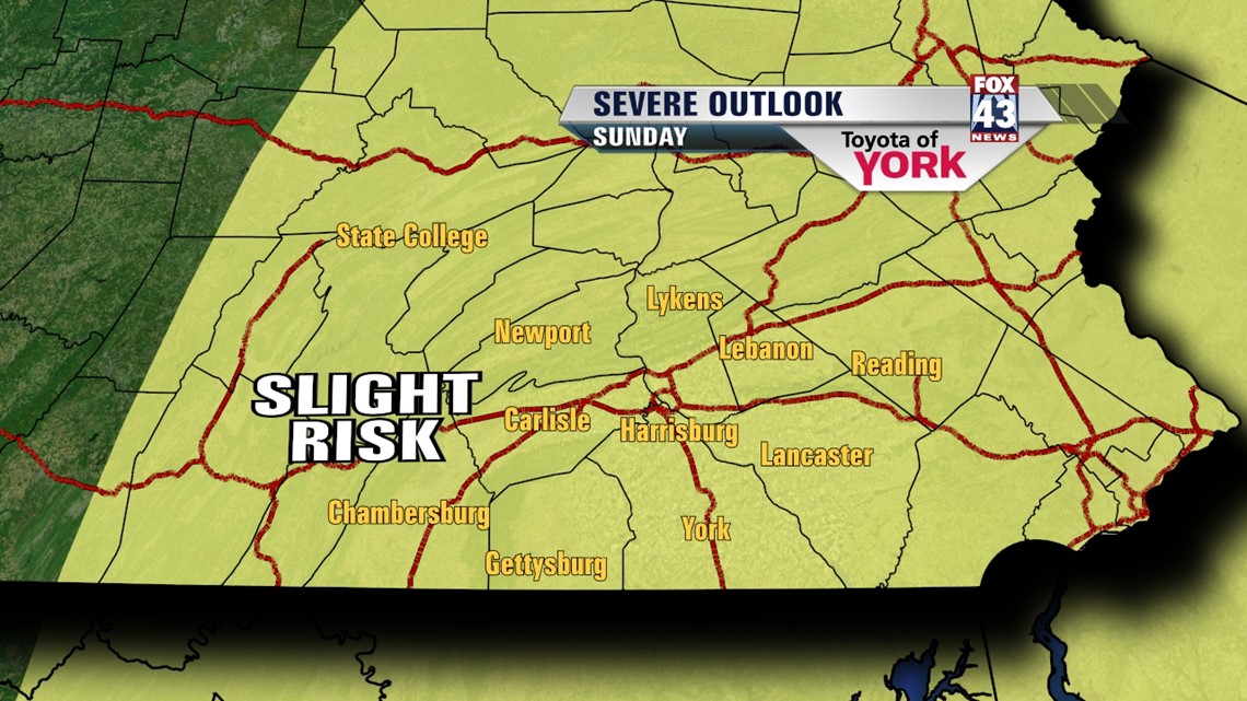
STORMY SUNDAY
A cold front in the mid section of the country right now is producing all kinds of severe weather. It arrives here on Sunday bringing a good chance for scattered showers and thunderstorms. Some of the storms may be strong to severe. The STORM PREDICTION CENTER has us in a SLIGHT RISK with the concern for damaging winds and hail being the main threat. We’ll be sure to keep an eye on things and bring you the latest. Highs will not be as hot but still quite warm in the mid 80s.

Showers and storms are still possible on Monday but temperatures will drop back to the mid 70s.
STRETCH OF 70s
Mid week through the end of the week, high pressure builds in bringing back drier air. Temperatures will be seasonal in the upper 70s under sunny skies until Friday when rain chances return.
MaryEllen Pann, Chief Meteorologist
Like me on Facebook: maryellenpannfox43
Follow me on Twitter: @MaryEllenFox43