
THURSDAY SEVERE: We’re done with round one of severe weather, and we await the potential for a second round later today. Please stay alert today and be ready to receive severe weather alerts through the remainder of the evening.

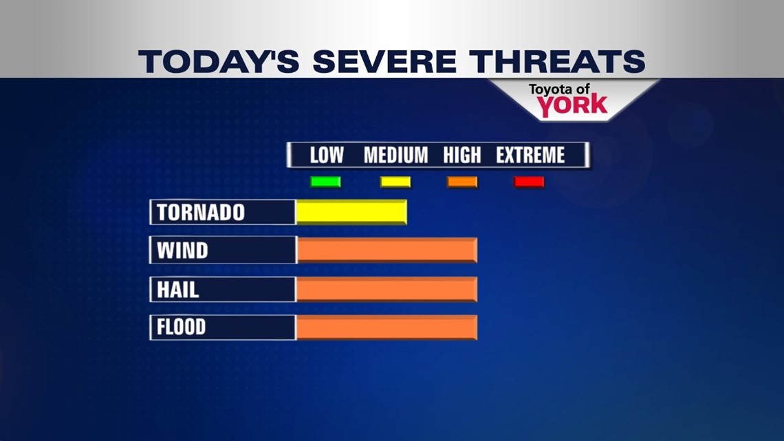

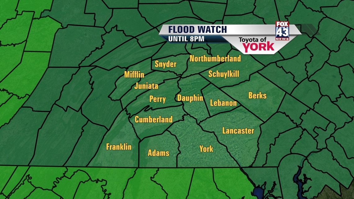
NEXT WAVE: The first wave ate up quite a bit of energy in place across the area today. The second wave is solely dependent on how well we can recharge the energy in the atmosphere this morning and afternoon. Any sunshine will help give us more energy. A surface low approaches coupled with the upper level energy which would be enough to spark and support more storms. We expect the window to open from roughly noon until 7PM, with the concentration of storms closer to the second half of the period. Any storms that form will have the potential for damaging winds and hail, along with an isolated tornado threat, as rotation is introduced to the atmosphere. Storms may also contain heavy downpours which may flood low lying, poor drainage areas as well as some of the smaller creeks and streams. Lightning will be frequent as well.
Again, there’s no grantee wave two will materialize fully, but there are enough indicators present that we need to be ready for it.
WINDING DOWN: After wave two exits this evening, showers will stick around for tonight, scattered in nature. We’ll pick up the winds as well, with 10-20mph and higher gust expected form the northwest. Friday will be cool and breezy with highs in the middle 70s. A few showers are possible during the day, but we’ll gradually clear.
WEEKEND: We have an awesome Saturday, courtesy of high pressure. Lots of sun, low humidity, and highs on target with average around 80° will be the name of the game. Sunday, a wave may bring some rain to the picture, but it’s still warm and partly cloudy with highs in the low 80s.
NEXT WEEK: We start with showers and storms on Monday. We’re in the low 80s. Scattered showers will taper Tuesday with highs holding steady. We’re clearing and warm on Wednesday at 80°.
Be sure to follow us on Facebook and Twitter for severe weather alerts. If you have a weather radio, keep it on today. Stay alert and stay safe! We’ll be here all day for you!
“Life is 10% what happens to us and 90% how we react to it.” – Dennis P. Kimbro
– Jeff Jumper, WPMT Fox43 Morning Meteorologist
Follow me on Twitter: @JeffJumperWX
Like me on Facebook: Jeff Jumper Fox43