
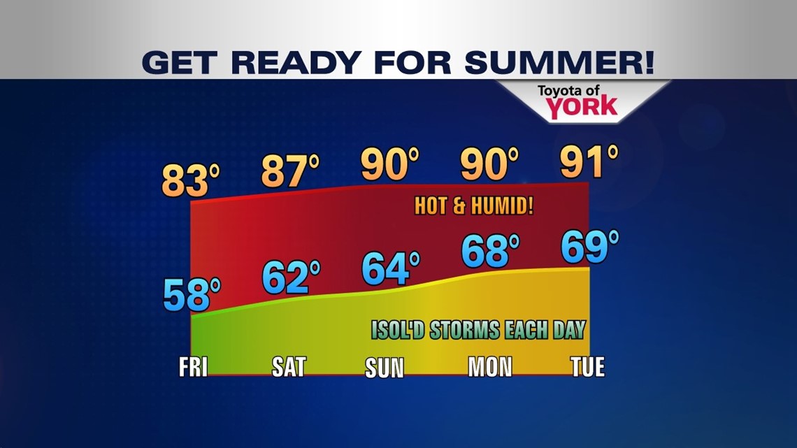
A strengthening upper level ridge of high pressure will bring very warm and humid weather to the area through early next week. Each day starting Sunday and beyond, there will only be an isolated shower and storm threat possible. As we head towards Wednesday and Thursday, the summer time pattern starts to change as a cold front pushes southward from the Great Lakes bringing a better chance for widespread showers and thunderstorms.
HELLO SUMMER!
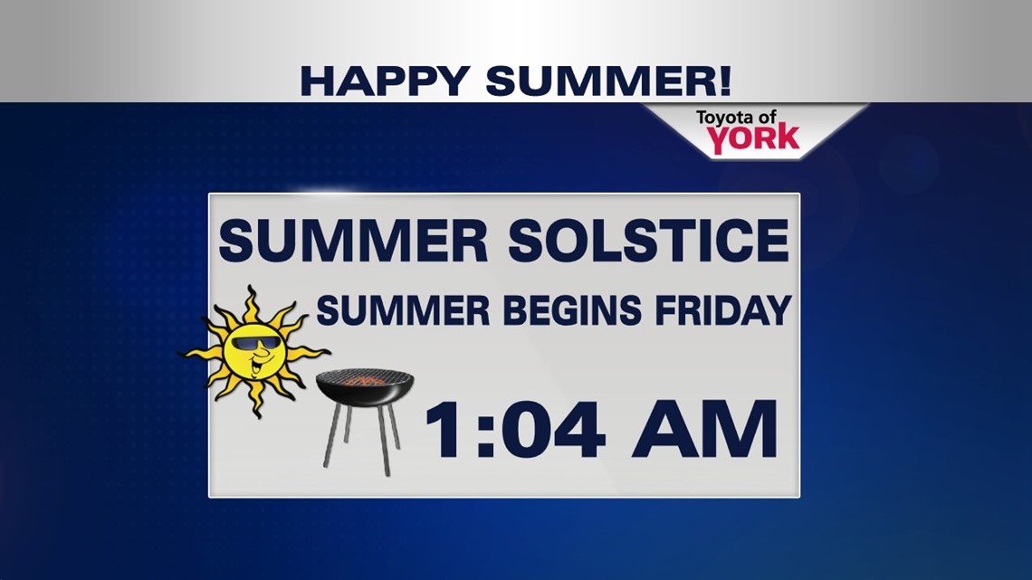
The summer solstice officially arrives at 1:04am. It starts off pretty decent with sunshine and seasonal high temperatures in the low to mid 80s. We will enjoy one more day with relatively comfortable humidity levels before it starts to get sticky and summer time heat builds in across the area..

TONIGHT
Clouds will clear for a good part of the night before we see fog develop in spots towards morning much like this morning. Lows will dip into the mid to upper 50s once again. Still feeling pretty nice out so take advantage and open the windows once again.
TURNING THE HEAT UP
Over the upcoming weekend, we will start a very warm and humid stretch of weather. There is an isolated threat for a storm Sunday but a better chance for scattered storms going into late next week. Despite the threat, rainfall will be scarce for a good stretch so be sure to water the lawns, gardens and outdoor plants!

MaryEllen Pann, Chief Meteorologist
Like me on Facebook: maryellenpannfox43
Follow me on Twitter: @MaryEllenFox43