
WET, WET, WET
An unseasonably deep trough will set up over the eastern have of the United States from the Great Lakes through the Mid-South into the weekend. This pattern means for us, slightly cooler temperatures and several opportunities for rain, some of which may be locally heavy. It looks as if this pattern persists into the early part of July.
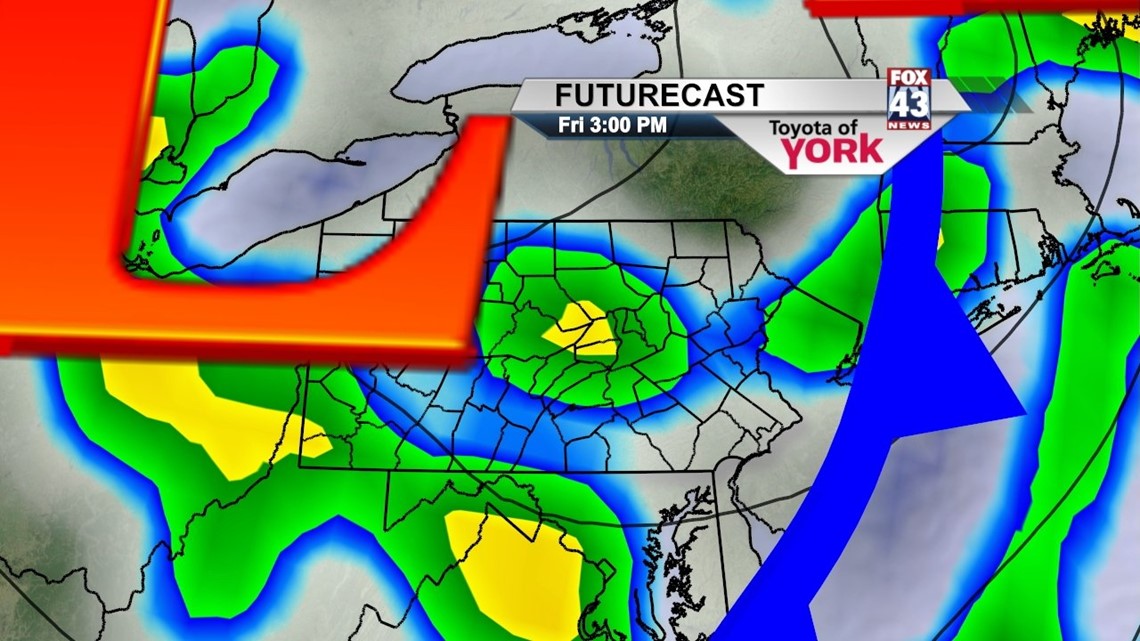
Showers possible again tomorrow along with a few thunderstorms. Don’t think we’ll see anything severe but could pick up a lot of rain from showers that roll through.

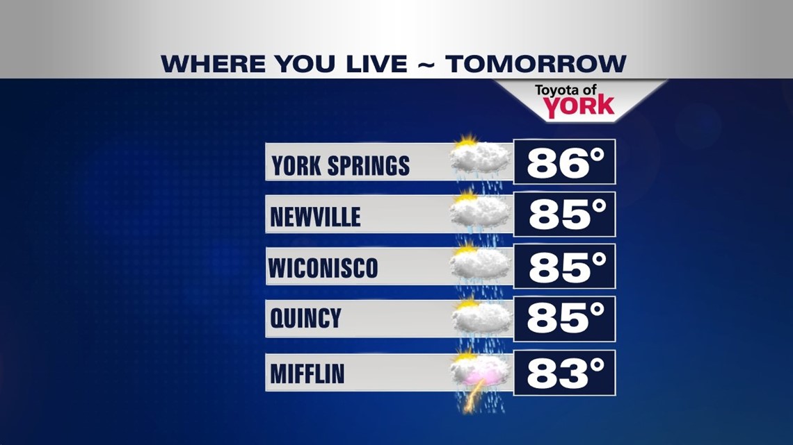
WHERE YOU LIVE
Here is a look at what you can expect in your neighborhood tomorrow.

UNBELIEVABLE STRETCH OF UNSETTLED DAYS
The trough moves in Friday into the weekend knocking temperatures back to the low to mid 80s which is more seasonal. However, the rain threat will continue each and every day through the end of June as well as the first week of July. Eventually the upper level trough lifts out but not until the end of the Fourth of July holiday.
MaryEllen Pann, Chief Meteorologist
Like me on Facebook: maryellenpannfox43
Follow me on Twitter: @MaryEllenFox43