

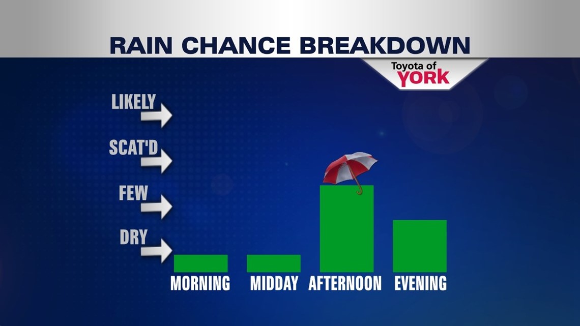
RUMBLES THROUGH THE EVENING


An area of low pressure has stalled north of the region, keeping the Lower Susquehanna Valley warm and unsettled. Scattered strong to severe thunderstorms are developing out west this afternoon as a result, and they are heading in this direction. The threat for severe weather continues for the rest of the day as the storms move east. Strong winds, hail, and localized flooding are the main threats. There is a very small, isolated tornado chance in our eastern parts. Once the sun sets and we lose daytime heating, the activity winds down. Overnight skies are partly cloudy with lows in the middle 60s.
MORE STORMS FOR THE WEEKEND
The weekend features a thunderstorm chance each day with the warm and sticky conditions continuing. The chance is isolated for Saturday, but expect it to become more widespread on Sunday. Some storms do have the potential to turn strong on Saturday. High temperatures are in the middle 80s each day.
STAYING UNSETTLED NEXT WEEK
It’s more of the same through the new workweek. The daily shower and thunderstorm chance continues Monday and Tuesday. The activity will be fairly widespread, keeping temperatures in the lower to middle 80s. By the middle of the week, a strengthening Bermuda high pressure system in the Atlantic dries us a bit. However, it’s not enough to completely chase away the shower and storm chance. Highs are warmed into the middle to upper 80s.
Have a great weekend!
-Andrea Michaels