

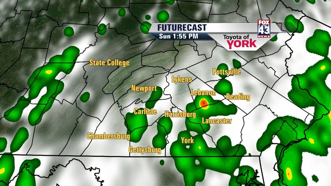
MORE STORMS SUNDAY

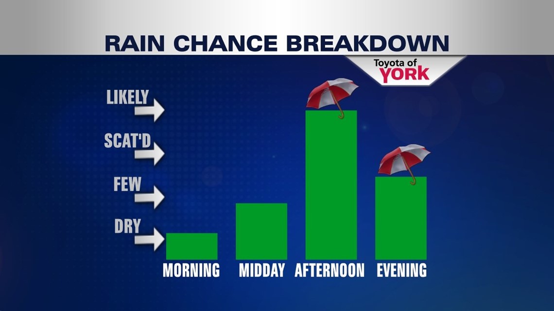
After some isolated showers and thunderstorms wind down, the overnight period remains dry. Expect partly cloudy skies with lows in the middle to upper 60s. More unsettled weather continues into Sunday thanks to the same persistent weather pattern. A strong Bermuda high in the Atlantic continues to prevent an area of low pressure from moving east. A stationary boundary forming nearby Sunday increases the shower and thunderstorm coverage. A few of the storms could be on the stronger, and a couple isolated severe storms are not out of the question. Highs reach the lower to middle 80s depending on sunshine.
STAYING UNSETTLED NEXT WEEK
It’s more of the same through the new workweek. The daily shower and thunderstorm chance continues Monday and Tuesday. The activity will be fairly widespread, keeping temperatures in the lower to middle 80s. By Wednesday and Thursday, a strengthening Bermuda high pressure system in the Atlantic dries us a bit. However, it’s not enough to completely chase away the shower and storm chance. Highs are warmed into the middle to upper 80s.
THE HEAT BUILDS BACK
The Bermuda high continues to strengthen through next weekend. It overcomes the unsettled upper level pattern and shifts the heat back into the lower Susquehanna Valley. There will still be a shower and thunderstorm chance, but it looks to be few. High reach the upper 80s to near 90 degrees Friday and Saturday.
Enjoy the rest of your weekend!
-Andrea Michaels