
This evening the rain threat tapers off. We should be dry and muggy for the overnight with lows in the upper 60s to low 70s.
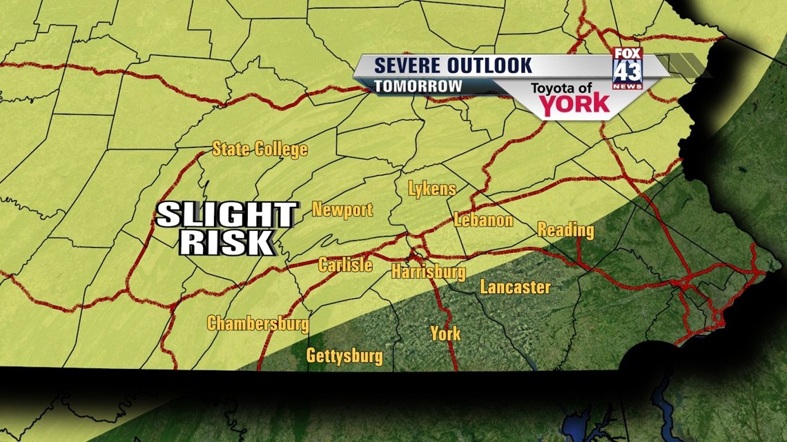
A strong cold front approaches tomorrow and crosses the area by Thursday morning. It will bring the threat for scattered showers and thunderstorms. Some of the storms may be strong to severe. The Storm Prediction Center has us in a slight risk for severe storms with the main threat being damaging winds and hail. Showers and storms will end as of now early Thursday morning in the west and may linger a bit longer further east. Highs with the clouds and wet weather will remain in the mid 80s.

For Friday and Saturday, skies will clear a bit allowing for more sunshine and there will be drier air settling in briefly. Temperatures will run in the low 80’s Friday, mid 80s by Saturday.
Our break from the heat and humidity will be short-lived as the trough lifts and ridge sets up once again over the east coast just like the past week or so. This means daily threat for showers and storms, humid days and highs hovering at or above average in the mid to upper 80s.
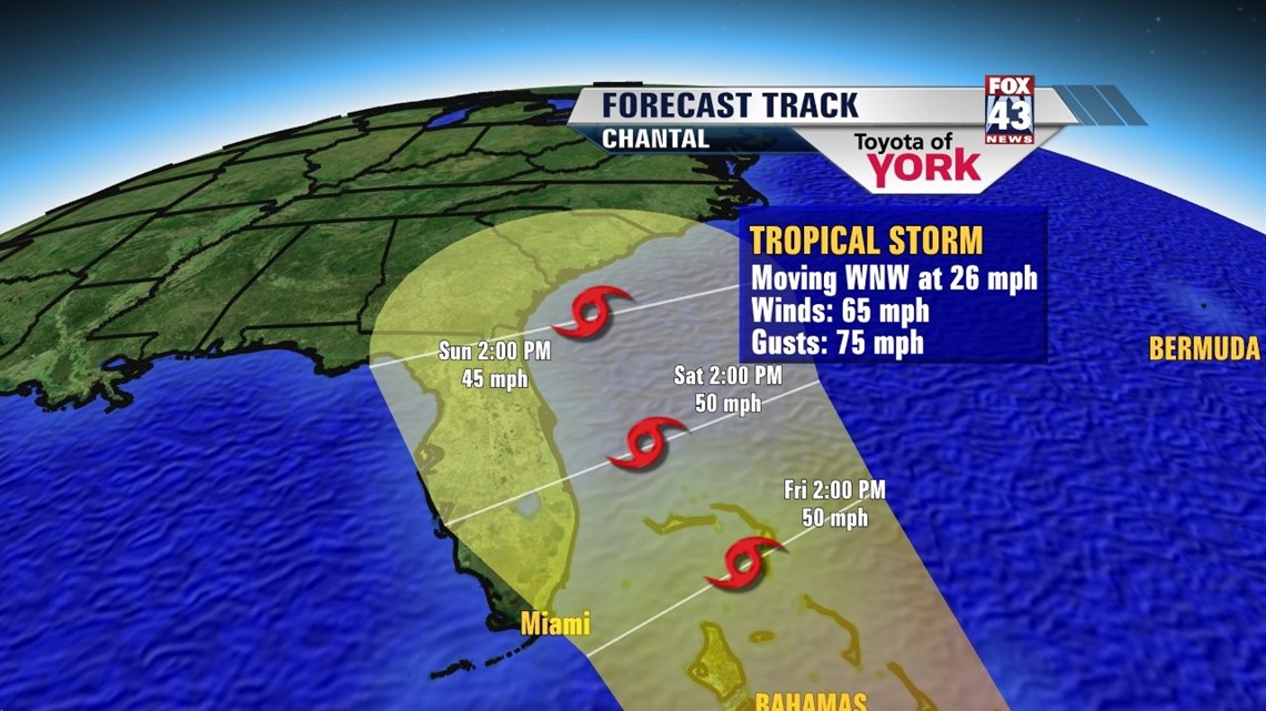
We are also watching a system in the tropics. “CHANTAL” is forecast to possibly move just off the southeast coast of Florida by the weekend.

MaryEllen Pann, Chief Meteorologist
Like me on Facebook: maryellenpannfox43
Follow me on Twitter: @MaryEllenFox43