
High pressure moving towards Maine will setup an east-northeast flow and aid in increasing the moisture across the area. More clouds overnight and fog is likely to form as well. Overnight lows will be closer to average in the low 50s.
TGIF!
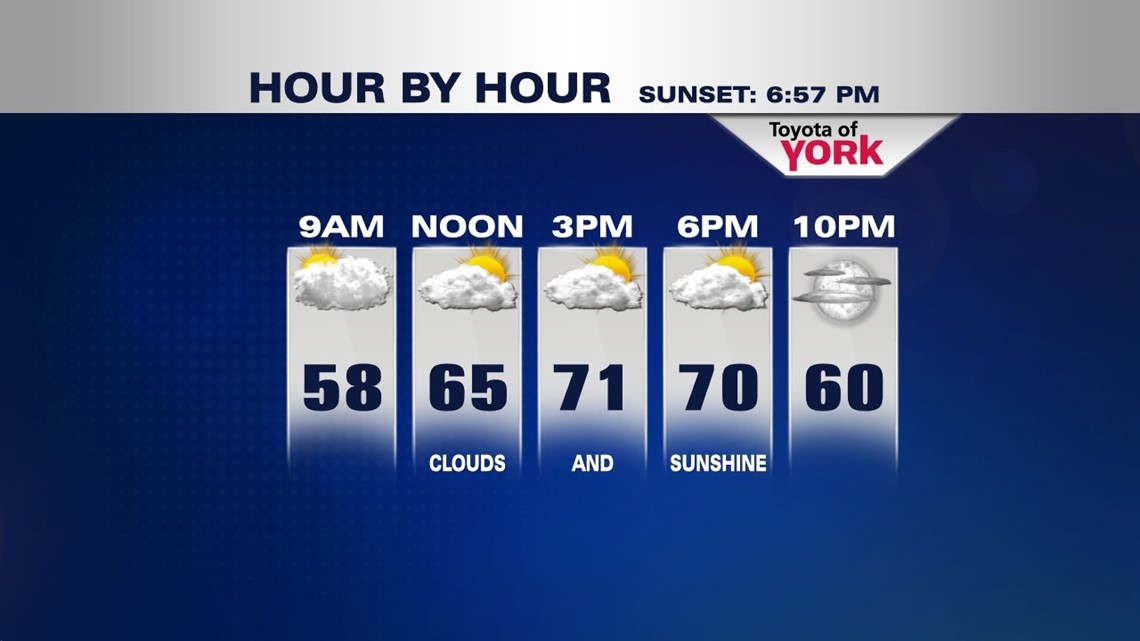
We’ll see more clouds for Friday with fog and mist in the morning and cool temperatures, but still ending on a dry note with once again near seasonal average highs a bit cooler than today but still warming to the low 70s under partly sunny skies.

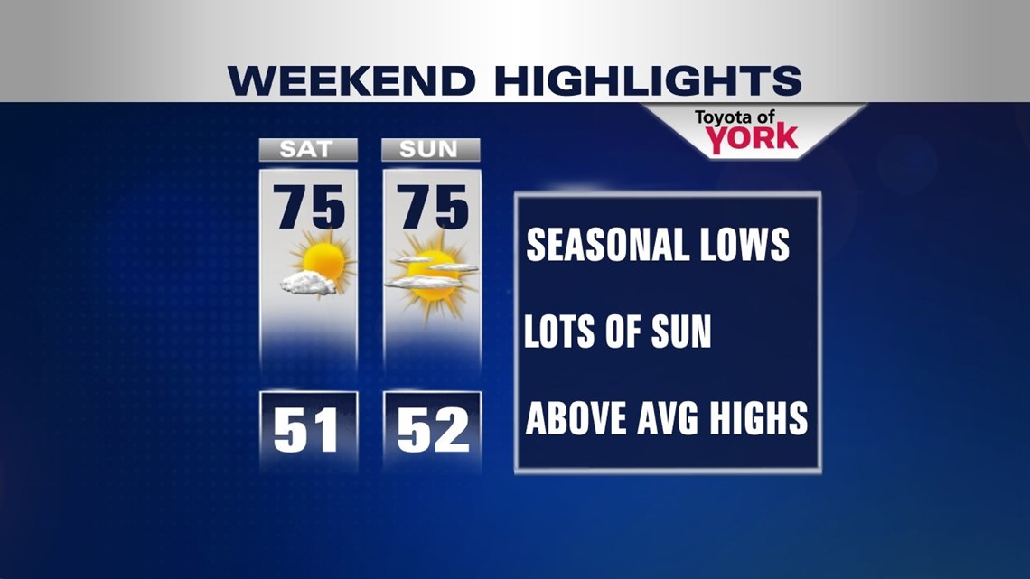
WEEKEND OUTLOOK
It still looks like we stay rain free through Sunday. High pressure dominates the area keeping the nice fall weather trend going. Highs will be the warmest of the week so far reaching the mid 70s. Lows near seasonal averages in the low 50s.

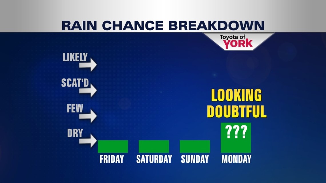
RAIN ANYTIME SOON?
Not looking likely with the next front but there is a small chance as a cold front comes in Monday. Models have been trending drier showing the front weakening by the time it gets here. We’ll certainly keep you posted. We need the rain!


STATUS QUO
Weather remains status quo heading into the start of October. Temperatures may warm a few degrees above average to the mid 70s under partly to mostly sunny skies. Tuesday we’ll have to watch a system to see if it may trigger a sprinkle for us but generally expecting a dry day. We continue the dry stretch into Thursday!
Enjoy fall!
MaryEllen Pann, Chief Meteorologist
Like me on Facebook: maryellenpannfox43
Follow me on Twitter: @MaryEllenFox43