
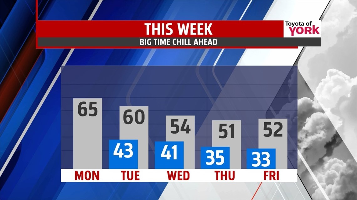
GREAT START: The work week starts on a fantastic note. We sit along the edge of high pressure to our south which will keep us sunny, cool, and dry today. Highs will hit the middle 60s. Tonight, we cloud up a bit as we anticipate the first of the next two systems that will eventually bring us some rain. Lows hit the low 40s.
NEXT UP: A weaker front rolls through on Tuesday, giving us partly cloudy skies and a few showers. Most will stay dry. Highs will be held close to 60° as the first batch of cooler air settles in. Then, a larger wave of energy makes its way through for Wednesday. This comes with mostly cloudy skies, scattered showers, and more notable chilly air! We’re talking middle 50s for highs on Wednesday!
COLDER AIR!: The colder air settles in to close out the week and lasts into the weekend. We’re in the low 50s Thursday with a breeze. Friday, we hold low to mid 50s. Saturday and Sunday, we’re in the mid 50s for highs. Each morning starts near the freezing mark, so we will likely see our first widespread frost of the season later this week.

Stay warm and be safe as many of you use the fireplaces and heaters for the first time this fall! Have a spectacular Monday!
“Life is really simple, but we insist on making it complicated.” – Confucius
– Jeff Jumper, WPMT FOX43 Morning Meteorologist
Follow me on Twitter: @JeffJumperWX
Like me on Facebook: Jeff Jumper FOX43