

COLD NIGHTS CONTINUE

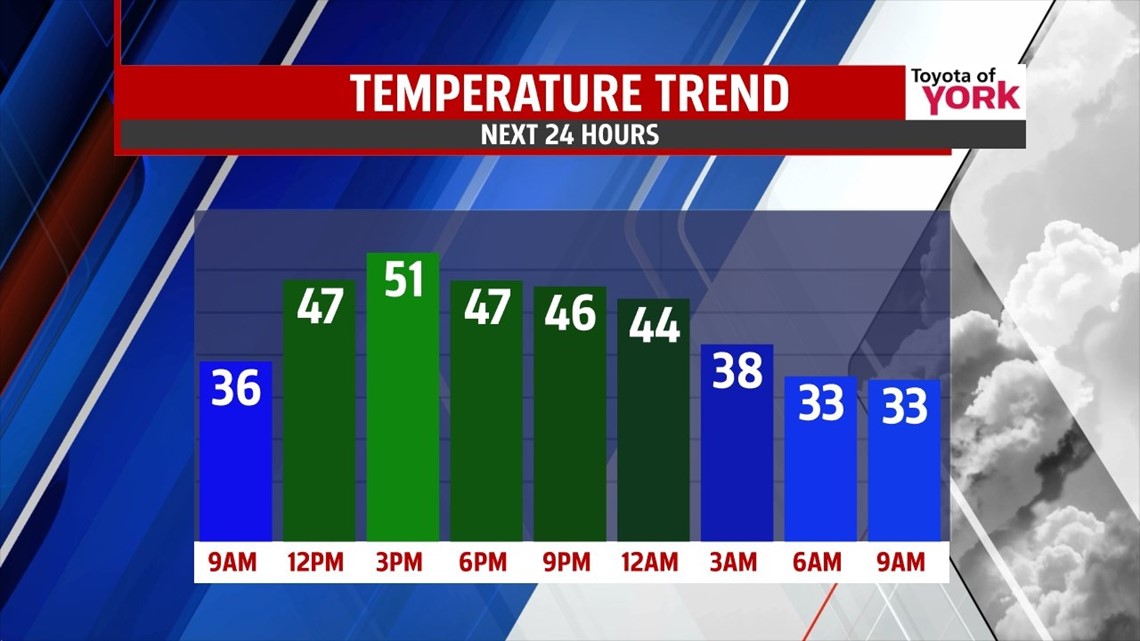
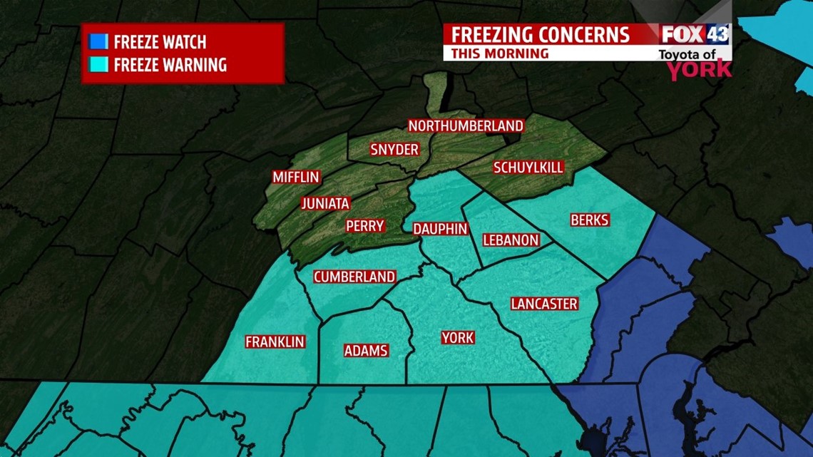
Temperatures begin in the 30s once again this morning! Expect plenty of frosty areas across the region too because of the chilly temperatures. Skies are mostly clear to start, with the exception being to the far north and northwestern parts of the area. With a continued northwest flow, afternoon clouds bubble up with all of the colder air aloft. Lake effect snow showers begin in the northwestern parts of the state, and a few flurries/sprinkles could clip the far northwestern parts (Mifflin and Juniata counties) of our region. Otherwise, expect sunnier conditions the further south and east you live. Highs during the afternoon reach the upper 40s to lower 50s.
NOT AS CHILLY THROUGH WEEKEND
Expect another chilly morning Saturday, with lows reaching the upper 20s to lower 30s. The rest of the day brings a sunny start, but an approaching weak cold front will increase clouds late in the day. Temperatures are a bit warmer again, but still below average in the lower to middle 50s. Sunday clears out, with highs in the middle 50s.
SLOWLY WARMING
The cool air continues to slowly lift out into next week, allowing a warmer flow to develop. This results in temperatures climbing closer to seasonable averages. Monday brings a mixture of sunshine and clouds with highs in the middle to upper 50s. A warm front approaches Tuesday and increases clouds. High are near 60 degrees. As for Wednesday and Thursday, showers are possible, with highs near 60 degrees.
Have a great weekend!
-Andrea Michaels