

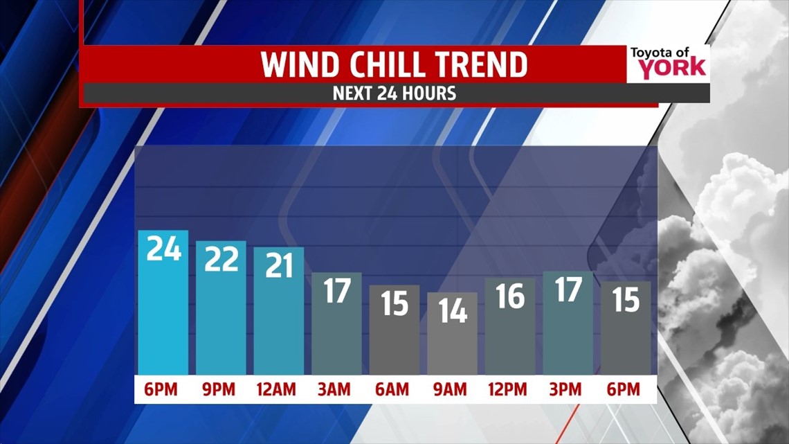
FRIGID NIGHTS AHEAD

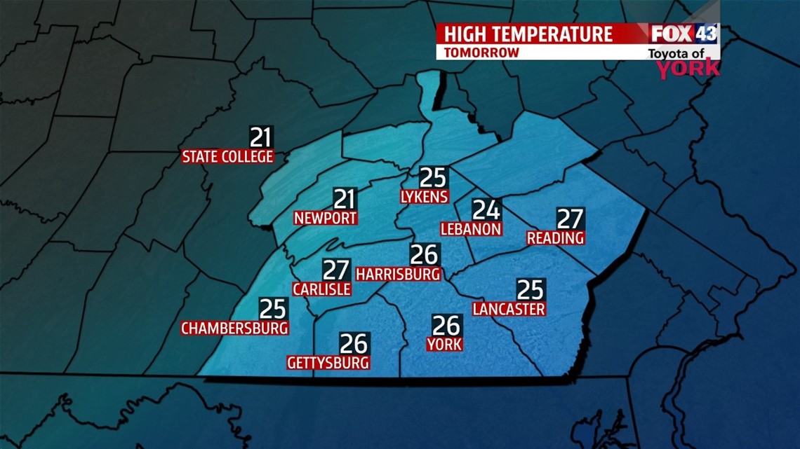
An arctic cold front slides through overnight, ushering in some of the coldest air so far this season. Clouds begin to increase through the evening hours. Late overnight, the clouds clear as the front exits the region. It leaves behind chilly temperatures to start the morning, with lows in the middle teens to near 20 degrees! It stays cold Thursday with a mixture of sunshine and clouds. The sun doesn’t do much to warm us. Highs are only in the lower to middle 20s! Wind chills will feel like the teens and even single digits at times. Overnight Thursday looks to be the coldest night this week. Lows are in the teens again, with winds chills in the single digits to near 0 degrees in some spots! Stay warm over the next couple of days! Temperatures begin to moderate a bit Friday, but it’s still an unseasonably cold day with highs near 30 degrees.
WATCHING NEXT STORM
Yet another storm system looks to bring a wintry mess to the area this weekend. Saturday could start off as some snow before changing to a wintry mix of sleet and freezing rain later in the day. As more specific details become clearer over the next day or two, we’ll bring that information to you. Everything looks to clear out by Sunday morning, but it’s a mostly cloudy day with some flurries in store. Highs are in the lower to middle 30s.
SLOW TO WARM
Temperatures remain below average through the beginning of next week. It’s dry, with intervals of sunshine and clouds. After starting around 30 degrees on Monday, high temperatures slowly climb into the upper 30s by midweek.
Have a great night!
-Andrea Michaels