
…A Winter Weather Advisory continues through 10AM for our area…

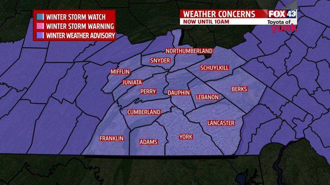
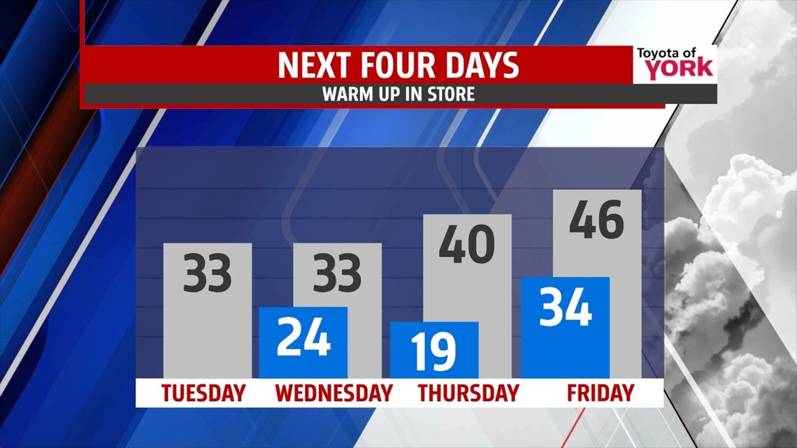
QUICK SNOW: Light snow began around 1-2AM in parts of the area. The light snow continues, on and off through the mid-morning hours, making for some slick roadways. As mentioned yesterday, we’re only expecting an inch or two in most spots and that looks on target. We may see a quick burst of some light snow later in the day today again as the energy for this system races eastbound. The cold air stays in place with highs in the low 30s.
CLOSING OUT THE WEEK: Wednesday, the sun returns, but it’s breezy and cold still. Highs hit the low 30s. Then Thursday the pattern shifts and we begin a much deserved warming trend. Highs are more seasonal, hitting the 40° mark on Thursday. Friday we make it the upper 40s. We’ll see the chance for rain arriving late in the day on a weak wave that moves through.

WEEKEND: A few showers are possible Saturday as a low forms and strengthens over the South. This will push northbound and bring us a few things. First, we’ll see temps warm nicely. Saturday we will hit the low 50s and Sunday we’ll top out in the 60s! We stay on the warm side of things, so no snow in the cards. Sunday, expect to see rain and maybe even a few thunderstorms, especially late. It all shuts off Sunday night, with colder air spilling in for the holiday week ahead.
Make it a terrific Tuesday. Stay safe on the roads today.
“You can do anything, but not everything.” – David Allen
– Jeff Jumper, WPMT FOX43 Morning Meteorologist
Follow me on Twitter: @JeffJumperWX
Like me on Facebook: Jeff Jumper FOX43