
RECORD BREAKING START TO WINTER
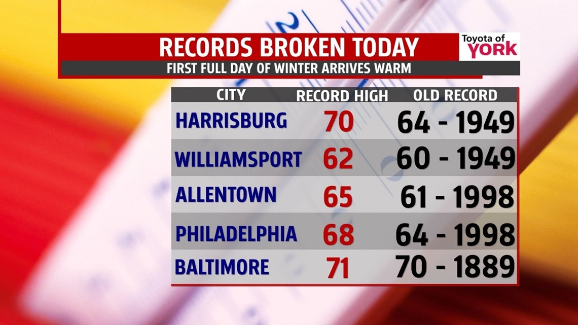
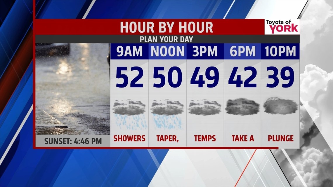
The first full day was very warm in fact, record breaking warm. Several cities across PA and the northeast broke records. Harrisburg hit 70 degrees this morning breaking the old record of 64 set back in 1949. We will say goodbye to the brief warm up as a cold front swings through tonight. Temperatures will be mild just after midnight but they will continue to drop through the day. We should see temps in the 50s early and in the mid to upper 40s by afternoon.

RAIN RETURNS BY MORNING FOR SOME

CHRISTMAS EVE AND CHRISTMAS DAY
Christmas Eve morning lows return to the 20s with highs much colder in the mid to upper 30s and it looks as if a strong piece of energy dives just to our south. It may trigger a few snowflakes in the afternoon and evening reminding us it is Christmas. No accumulations are expected. Unfortunately, if you are looking for a white Christmas, you will have to wait. It will be cold with lows in the low 20s and highs in the low 30s; however, it will be dry with plenty of sunshine.
QUIET, DRY STRETCH
Thursday there will be more clouds around as a system skirts by to our north. Highs will be milder near 40. Once the front moves through it will knock temps back down for Friday. Plenty of sunshine Friday with high pressure in control but temperatures only warm to the mid and upper 30s. A nice start to the weekend with sunshine and highs in the upper 30s to near 40. Winds shift for Sunday bringing in milder air boosting temps to the mid 40s under partly to mostly sunny skies.
Happy Holidays!
MaryEllen Pann, Chief Meteorologist
Like me on Facebook: maryellenpannfox43
Follow me on Twitter: @MaryEllenFox43