
MOSTLY CLEAR AND COLD NIGHT
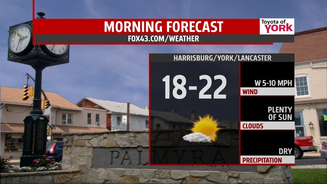
After morning snow, the sun has come out as clouds have broken up nicely helping to start the melting process. Overnight, high pressure builds in across the area and controls our weather into the weekend. It will be cold but seasonal as lows dip to near 20 degrees.

QUIET, DRY STRETCH
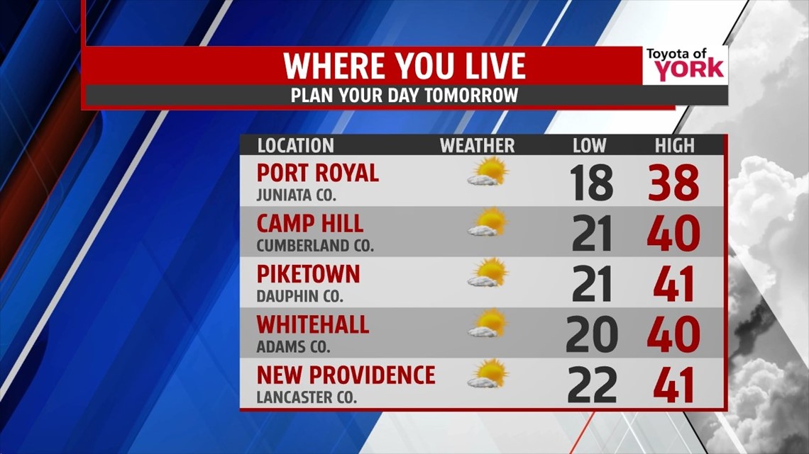
Plenty of sunshine tomorrow with high pressure in control and a nice climb to the upper 30s to around 40 will surely rid of the snow. The high will shift eastward and allow for winds to shift more southwesterly which will transport milder air for the start of the weekend. Highs Saturday will reach the upper 40s to near 50 degrees.

SUNDAY SYSTEM
A developing southern stream system rides up the coast. The westward extent is still in question. Right now the temperature profile supports rain showers for much of the Susquehanna but further north and west of Harrisburg, where temperatures will be colder; we may have to keep an eye on the forecast because it is possible we could see more of a wintry mix. Sunday looks to start out dry but showers will move in by early afternoon and continue into the evening. We’ll watch the track of the low and adjust the forecast as needed. Highs Sunday should make it to the low 40s before the precipitation starts to fall.
2013/2014
Monday, a cold front sweeps the area early in the morning. It may produce a few light snow showers or flurries and will certainly usher in much colder air as we round out 2013! Brisk winds for the start of the week will make highs in the low to mid 30s feel more like the 20s. New Year’s Eve will be even colder with lows in the teens and highs remaining in the 20s but it will be dry for bringing in 2014!
Happy Holidays!
MaryEllen Pann, Chief Meteorologist
Like me on Facebook: maryellenpannfox43
Follow me on Twitter: @MaryEllenFox43