
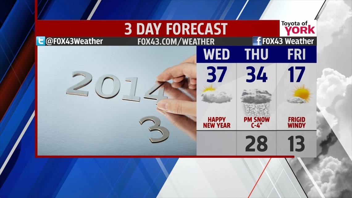
SEASONAL START: Happy New Year! The start of 2014 will be seasonably cold and mostly cloudy with temperatures hanging out in the upper 30s under light winds. It’s a quiet day with the majority of any snow confined to northern PA. We bottom out in the upper 20s tonight.
THURSDAY SNOW: We’ll start the day cold and dry under generally cloudy skies. Much of the morning and even the midday hours look dry at this time. A coastal low will be strengthening to our south and east, while a weaker low will be moving in from the northwest. The interaction between these two is key to our forecast. As of now, it looks like we’ll only see a minor snow storm.

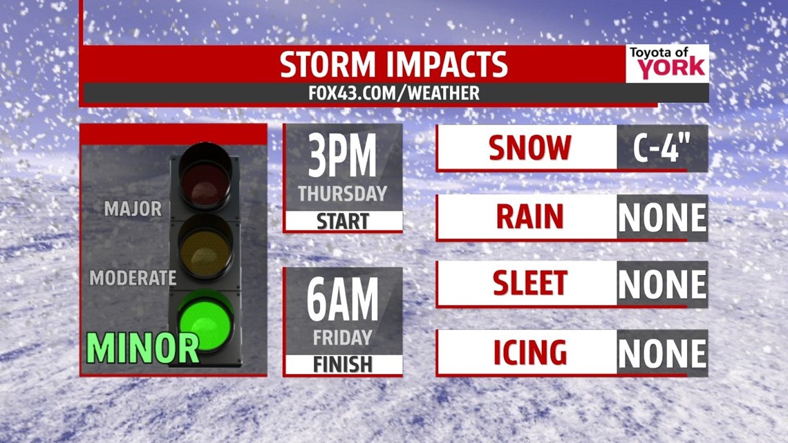
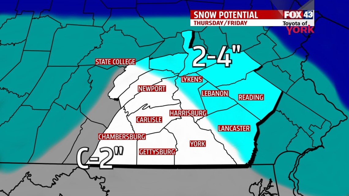
The snow begins in the afternoon between 3-5PM. Then, snow will quickly intensify as the northern low loses energy to the coastal system. Heaviest snow falls later in the evening, before tapering off during the overnight hours. Any leftover snow showers should come to a close around 6AM Friday. South and western spots may see a coating to 2”, while northeastern spots will range from 2-4”. These numbers may change just a bit, but overall it looks like we’ll stay on the low end side of snow amounts. There is a small chance southern counties may mix with rain early, but it’s not the favored idea at this time.

FRIGID BLAST: While the snow ends Friday morning, northwest winds will ramp up to 15-25mph with higher gusts. This will slam arctic cold air into the state for Friday morning. Temps will be in the teens with wind chills easily in the single digits and negative numbers. The windy weather continues for Friday as temps only make it to the middle and upper teens with continues brutal wind chills. Skies will feature some sun and clouds for what it’s worth!

WEEKEND: Saturday begins in the single digits with little wind. We warm to near 30° with sunshine for the afternoon. The warming continues Sunday as we start in the low 20s and end in the upper 30s. Clouds fill in Sunday and rain looks to push in after dark. The rain continues overnight and may switch to some snow before ending early Monday.
ARCTIC BLAST AGAIN: Models are indicating a brutally cold stretch for next week too. After the precip ends Monday, the winds pick up and a vortex of arctic air plunges into the Northeast. Temps will be in the single digits and low teens late Monday into Tuesday and Wednesday.
Make it a wonderful Wednesday and a prosperous 2014.
“Write it on your heart that every day is the best day in the year.” – Ralph Waldo Emerson
– Jeff Jumper, WPMT FOX43 Morning Meteorologist
Follow me on Twitter: @JeffJumperWX
Like me on Facebook: Jeff Jumper FOX43