
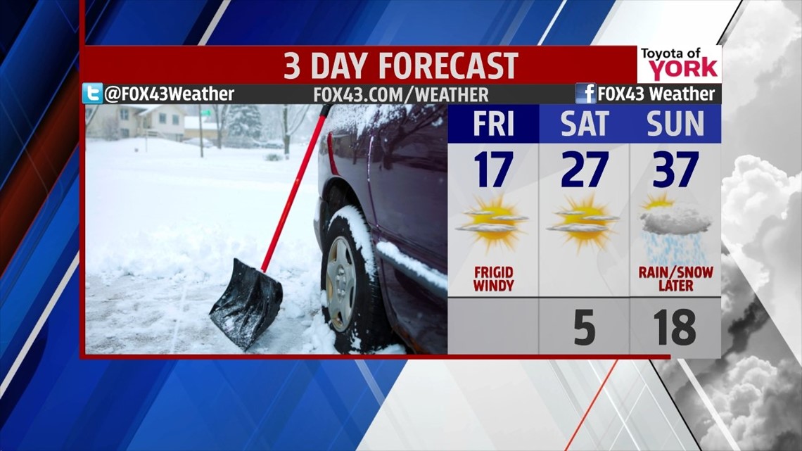
ARCTIC BLAST: With the snow ended, the frigid, arctic air continues to slam into the state on strong and gusty northwest winds. Temperatures are in the teens with wind chills easily in the single digits to negative numbers. Through the day today, we only budge a bit in temperatures, moving in the upper teens with wind chills at times around 0°. We’ll see sunshine but it will do little to warm us. We’ll also be dealing with blowing snow through the day. Tonight, the winds relax and temps dip to single digits easily with a fresh coating of snow on the ground.
WEEKEND: Saturday’s arctic start ends on a moderating cold note. Under sunshine, we’ll hit the upper 20s. We’re down to the teens overnight. Sunday, temps make it to the upper 30s on southwesterly flow. Clouds fill in and rain arrives later in the day as another system moves in from the south. Rain will end as some snow early Monday as temps fall to the low 30s.

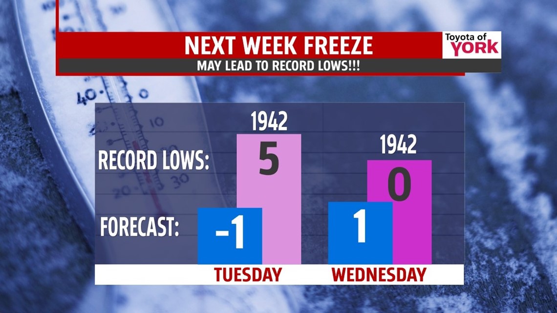
ANOTHER DEEP FREEZE: Monday, the clouds slowly break up as the precip ends early. We’ll return to strong, gusty winds as the arctic air moves right back into the state. Temps begin to fall into the 20s by midday with negative single digits overnight into Tuesday. Wind chills will easily be into the dangerous negative teens. We’ll stay cold Tuesday with highs near 10° and Wednesday we’re back to near 20°. Thursday we make a run for 30° with clouds back and even some light snow possible.

Have a safe and warm Friday!!!
“Write it on your heart that every day is the best day in the year.” — Ralph Waldo Emerson
– Jeff Jumper, WPMT FOX43 Morning Meteorologist
Follow me on Twitter: @JeffJumperWX
Like me on Facebook: Jeff Jumper FOX43