

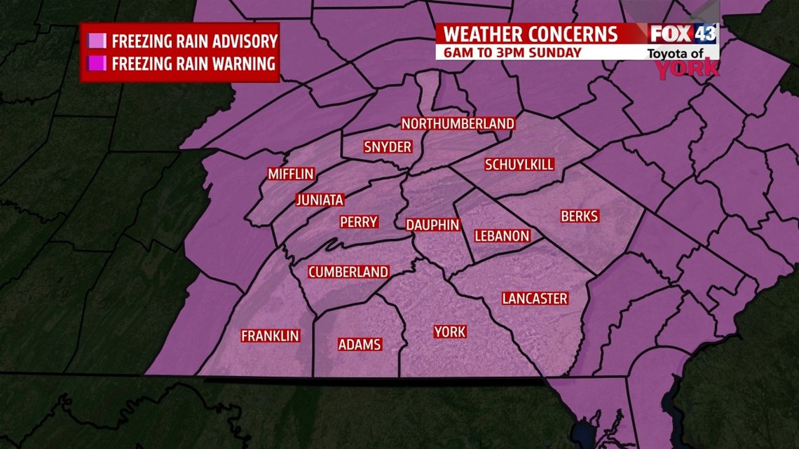
**A Freezing Rain Advisory is in effect for the entire area from 6 A.M through 3 P.M. Sunday.**
ICY START FOR SUNDAY

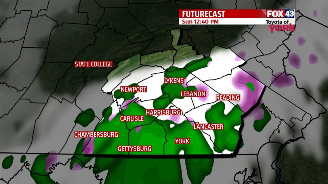
Our next storm system approaches from the west, and with winds shifting to the southeast tonight, clouds thicken overnight. Lows are chilly once again, falling into the teens to lower 20s. Southeasterly winds help produce patchy areas of drizzle and light rain, but with temperatures still well below freezing at daybreak, any drizzle or light rain freezes on contact to roads and other surfaces. This threat continues for the area until temperatures rise above freezing from late morning to mid afternoon from south to north. Then scattered showers and drizzly areas continue at times through the evening hours. Total ice accumulations range from a light glaze to a tenth of an inch for most, but some places could see as much as two tenths. This will make the roads and sidewalks icy and hazardous. The winds pick up through the day. Overnight Sunday temperatures peak in the upper 30s to lower/middle 40s. A round of rain along a cold front passes through around daybreak through the morning hours Monday. At the very end, some brief snow is likely, but only enough to bring minor accumulations at best (under an inch). Behind the front, the coldest air we’ve seen since 1994 slams into the region, and temperatures drop into the 20s during the afternoon. Strong winds bring brutal wind chills. Temperatures continue to drop, bringing even colder air than we experienced this morning!
POLAR BLAST
The coldest air since 1994 settles in Tuesday morning! Subzero temperatures are expected across the entire region. Breezes make it feel like -10s and -20s at times! Bundle up to prevent frostbite for those who must venture out Tuesday morning. Highs Tuesday only reach the single digits! Breezy winds produce wind chill values below 0 throughout the day. Wednesday sees another brutally cold start with temperatures ranging on both sides of 0 degrees. Highs do rebound to near 20 degrees. Sunshine both days does nothing to help warm us.
THAWING OUT
Thursday a clipper system looks to bring some light snow to the area. Accumulations should be minor. Highs are near 30 degrees. Friday we get a break, with temperatures continuing to warm above freezing under sunshine! Saturday brings our next chance for showers, and temperatures rise above 40 degrees.
Enjoy the rest of your weekend!
-Andrea Michaels