
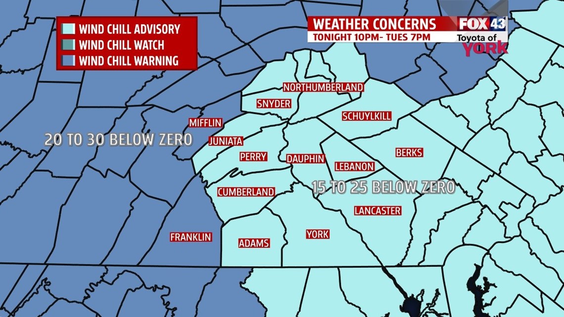
WIND CHILL WARNING IN EFFECT FOR 10PM THIS EVENING TO 7AM WEDNESDAY FOR MIFFLIN AND FRANKLIN COUNTIES.
Dangerous wind chill readings of 20 to 30 below zero will be likely from late tonight through Wednesday morning. Frost bite and hypothermia will be possible for those exposed to the cold without proper attire. Gloves, hats, scarves, multiple layers and a very heavy coat are recommended. Limit your skin exposure if at all possible.
WIND CHILL ADVISORY REMAINS IN EFFECT FROM 1AM TO 7PM TUESDAY FOR THE REST OF THE AREA.
Dangerous wind chills of 15 to 25 below zero likely tonight and through the day Tuesday. Again frostbite and hypothermia will be possible for those who leave skin exposed to the cold. Actual air temperatures will only be zero to 10 above tomorrow.

COLDEST AIR IN ALMOST 20 YEARS
Skies will clear this afternoon but the winds will pick up to out of the west to 30mph while temperatures continue to fall leading to wind chills well below zero. Wind chills this evening will be in the negative single digits. Overnight, lows will fall to -2 to 3 above zero, combined with winds 20 to 30mph, that brings wind chills to dangerous numbers from -10° to 25° and in warning areas 30° below zero.
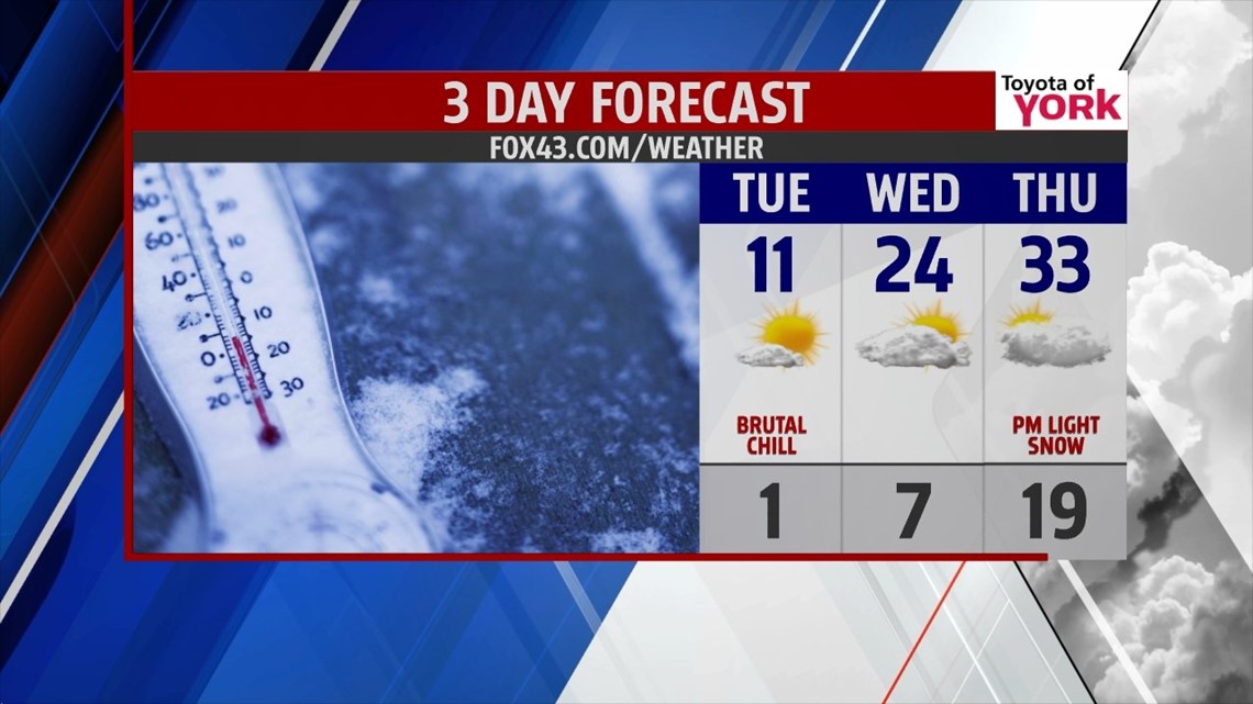
Tuesday, sunshine mixing with clouds but highs will only muster the low teens with wind chills staying well below zero.
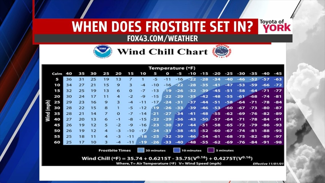
WHEN DOES FROSTBITE SET IN?
Here is a look at the Wind Chill Chart from the National Weather Service. You can cross reference temperatures at the top with wind speeds along the left hand side to get wind chill temperatures and see where they fall in the color coding chart. Most of the area will experience 15 to 25 below wind chills which means exposed skin will experience frostbite in less than 30 minutes.

HELPFUL INFORMATION
While we will be dealing with dangerous wind chills, the cold air may freeze up car radiators not properly treated with antifreeze. Plumbing along non insulated walls and in crawl spaces along the outside edge of the home may also be vulnerable to freezing do to the frigid cold. Leaving just a trickle of water flowing from the faucet can minimize the formation of ice in the pipes where there isn’t a lot of insulation. Turning up the home thermostats for the next couple of day or so may also help to keep pipes from freezing.
GRADUAL WARMUP
Temps will gradually warm up from the single digits early Wednesday to the low to mid 20s under mostly to partly cloudy skies. Thursday, we’ll have increasing clouds but temps will reach the lower 30s out ahead of our next quick moving system. It arrives late Thursday into Friday and may bring some light snow with it. Friday should see highs reaching 40 despite the passage of the front.

WEEKEND WARMTH, HURRAY!
We are looking at much milder temperatures for the weekend with highs in the 40s and perhaps even 50s. Showers will be likely for Saturday but Sunday looking to be dry.
Please stay warm and remember your pets!!!!
MaryEllen Pann, Chief Meteorologist
Like me on Facebook: maryellenpannfox43
Follow me on Twitter: @MaryEllenFox43