

SLOWLY THAWING


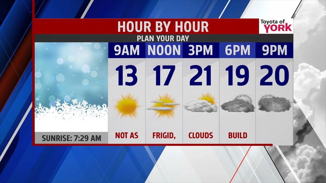
After record breaking chill on Tuesday, temperatures continue to slowly warm after the next couple of days. It’s another arctic start this morning, with temperatures in the single digits. Light winds could dip wind chill values as low as -5 to -10 degrees. There is plenty of sunshine to start, but clouds build during the afternoon as some moisture tries to work east. Highs reach the upper teens to lower 20s. Skies are mostly cloudy overnight as the moisture creeps closer. However, it’s sandwiched between two highs, so it loses a lot of its punch. Just expect a few flurries late overnight. Lows hold fairly steady in the teens to near 20 degrees. Thursday, a few morning flurries are still possible. Otherwise, it’s a mixture of clouds and sunshine with highs approaching the freezing mark.
WET ‘N MILD
Friday the warming trend continues. Temperatures climb to near 40 degrees. However, models are indicating a few flurries and sprinkles in the vicinity. Our best chance for rain showers comes along as a cold front that pushes through Saturday afternoon through the overnight. Highs reach the upper 40s to near 50 degrees! Sunday, highs begin around 50 degrees just after midnight, and then drop as the cold front crosses through. It’s mostly cloudy, with afternoon highs peaking in the 40s.
FAIRLY QUIET
Monday and Tuesday look rather uneventful right now, but they’ll be a bit on the milder side. Partly cloudy skies are expected Monday, with highs in the lower to middle 40s. Tuesday there is a chance for a few rain and snow showers as our next system approaches. Highs drop a little, hanging around the 40 degree mark.
Have a great Wednesday!
-Andrea Michaels