
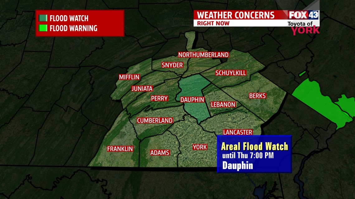
FLOOD WATCH in effect for Dauphin County until 7pm tomorrow. An Ice Jam on the Susquehanna River is causing water to back up on the Swatara Creek near Middletown. This could result in minor flooding along the creek in the vicinity of Middletown. Keep an eye on the potential for rising water and flooding.

IMPROVING TEMPS
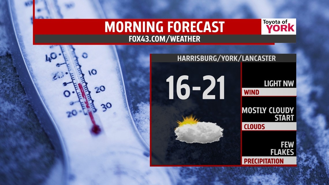
We cracked 20° today in most areas and temps will hover there through the evening. They will fall only a few degrees overnight into the teens to near 20 as clouds draped across the area remain. There may be a few flakes that fly by but should be nothing more. Winds will be light out of the s and will shift to the northwest tomorrow morning.

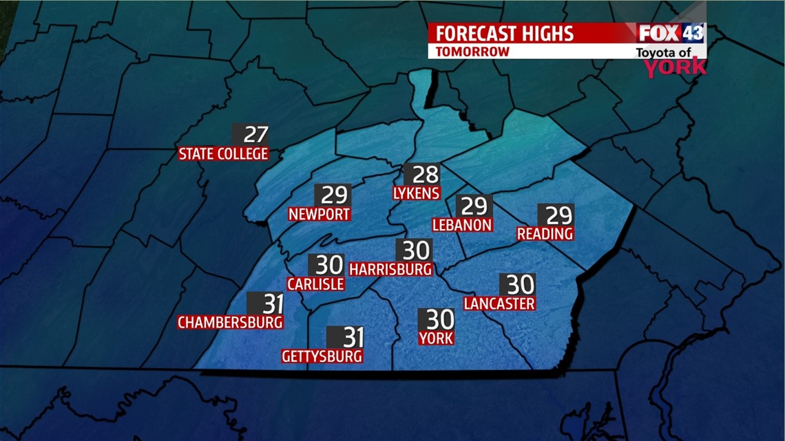
EYES ON 30°
A little disturbance passing by early in the morning will be to our east helping to shift our winds to the northwest. They will remain light and as the system pulls away, the clouds will break up allowing for a period of sunshine before they fill back in later in the afternoon. Highs will warm into the upper 20s to lower 30s.

MILDER BUT UNSETTLED HEADING INTO THE WEEKEND.
A disturbance moving in early Friday may produce light snow which may amount to a coating on the ground. Temperatures will be in the 20s to start the day but with the winds shifting, milder air will lift in and highs will head to near 40° despite the cloud cover. Friday night, there could be some light drizzle or sprinkles but the best chance for showers arrives Saturday along with much warmer air. Temperatures will climb to the upper 40s through the afternoon and remain mild into the evening. A cold front crosses the area Saturday night into Sunday morning but colder air is slow to rush in and we are near 50 by Sunday with morning lows in the upper 30s to low 40s.
STILL QUESTIONABLE EARLY NEXT WEEK
It looks like above average temperatures continue into Tuesday at which time a digging trough brings colder air to the east coast. There may be a few rain or snow showers during the day as temperatures fall through the afternoon. Models don’t completely agree but we will keep you posted.
Milder air is just around the corner, hang in there!
MaryEllen Pann, Chief Meteorologist
Like me on Facebook: maryellenpannfox43
Follow me on Twitter: @MaryEllenFox43