
FLOOD WATCH ISSUED FOR TOMORROW
The National Weather Service issued a FLOOD WATCH for tomorrow afternoon through Sunday evening. Warming temperatures will cause melting and ice break up on waterways. The combination of potential ice jams and forecasted rainfall amounts of anywhere from a half an inch to an inch or more could result in flooding.
Ice jams can form quickly and cause sharp water rises especially on the smaller streams and where tributaries flow into main stem rivers.
There is the potential for minor flooding on small streams, creeks and in poor drainage areas.
Please keep a watchful eye out if you live in or nearby a flood prone area. We’ll keep you posted through the evening and all day tomorrow with the latest.

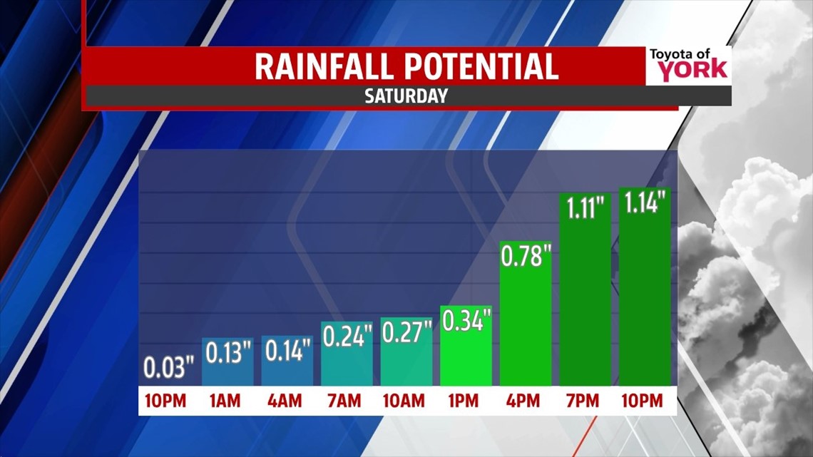
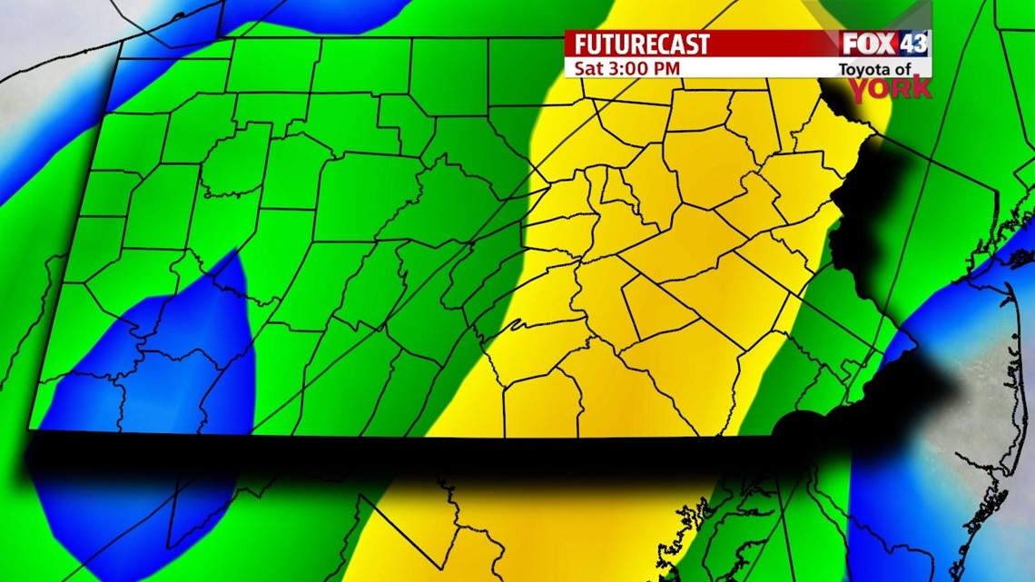
RAIN COULD BE HEAVY AT TIMES
A cold front scooting in from the west will bring rain ahead of it and mild temperatures. We could see highs in the mid to upper 50s. Showers will be light to start but pick up heading through the afternoon. They should taper with the passage of the front in the evening hours.

MILD STILL MONDAY
Temperatures will climb once again to near 50 as high pressure keeps us dry with sunshine. The next system arrives Tuesday which will slowly bring colder air back to the area. It will be the transition day and it looks like above average temperatures in the mid to upper 40s continues but a digging trough brings colder air back to the east coast gradually through the afternoon and evening. There may be a few rain showers during the day. We are back to the 30s by Wednesday and Thursday. There could be isolated flurries for Wednesday.
MaryEllen Pann, Chief Meteorologist
Like me on Facebook: maryellenpannfox43
Follow me on Twitter: @MaryEllenFox43