

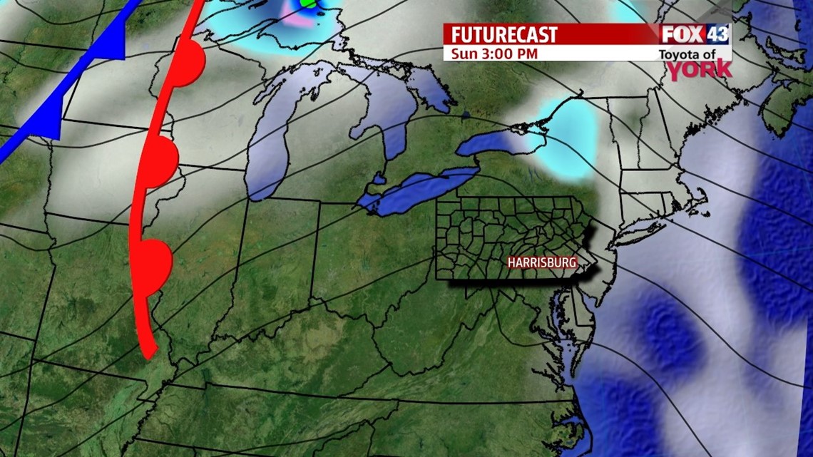
DRYING OUT

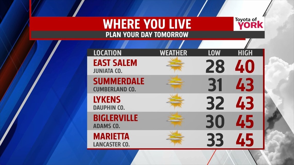
Rain showers along a cold front continue to exit from west to east through early evening. In the wake of the front, expect drying skies and cooling temperatures. Skies clear out through the overnight period, and temperatures drop into the upper 20s to lower 30s. A few icy spots could develop late as wet areas refreeze for some. Sunday brings plenty of sunshine to the area. It’s a bit breezy, with high temperatures above average. Expect readings in the lower to middle 40s.
STAYING ABOVE AVERAGE
Monday is still dry and filled with sunshine. It’s also a bit milder, with highs in the middle to upper 40s. A few clouds begin to build in during the afternoon hours. This occurs as a weak system approaches, and it brings a chance for showers Tuesday. Highs are still mild Tuesday, reaching the upper 30s to lower 40s.
COOLING THROUGH WEEK’S END
A cool down begins on Wednesday with temperatures falling into the middle 30s. A weak system passing through could bring some flurries or snow showers. The area dries out by Thursday, with a mixture of sunshine and clouds expected. A colder shot of air begins working into the area late Friday, and this could spark some flurries. Saturday, it’s a return to frigid temperatures. Highs drop from the 30s through the end of the week into the 20s by Saturday.
Enjoy the rest of your weekend!
-Andrea Michaels