

STAYING ABOVE AVERAGE

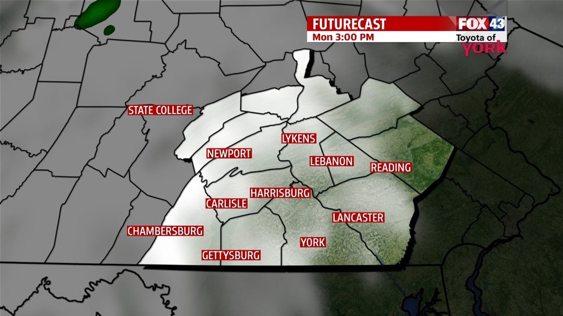
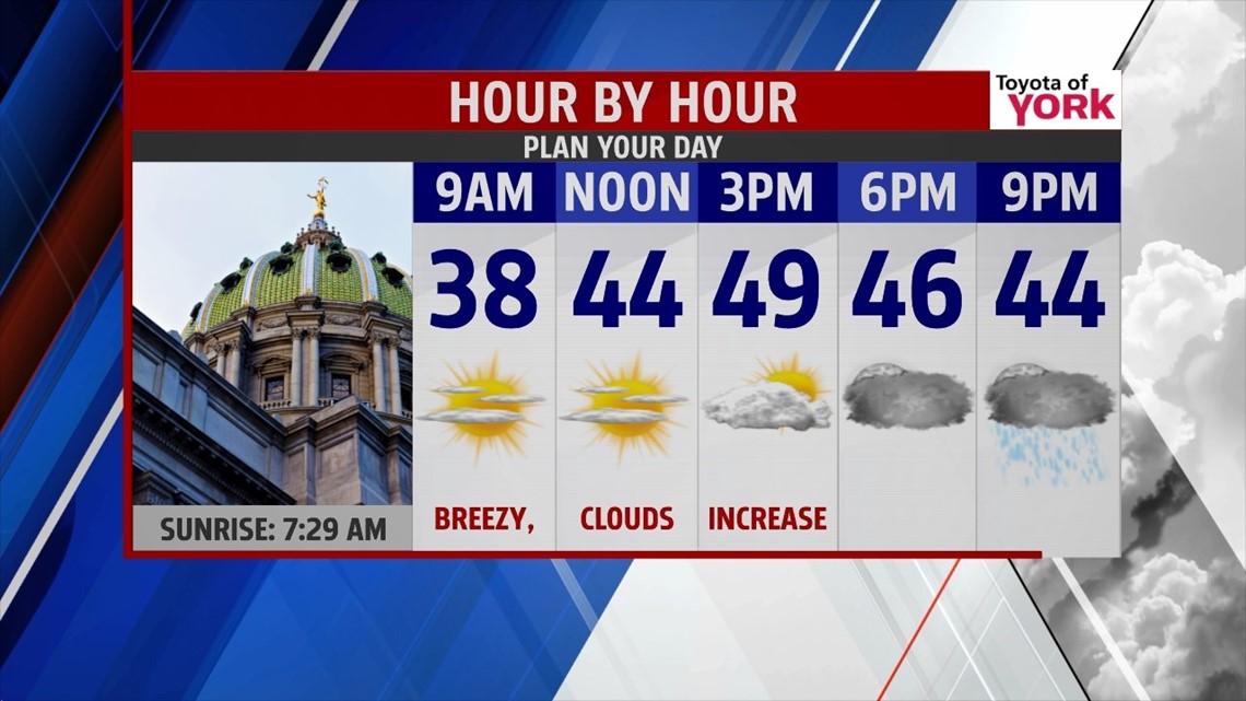
The clouds continue to crumble as we move into the evening hours, with mostly clear skies remaining. The winds taper temporarily during the night. Lows fall into the upper 20s to lower 30s. Monday is still dry and filled with sunshine to start. It’s also a bit milder, with highs rising in the middle to upper 40s due to breezy southerly winds. Clouds begin to increase throughout the day. This occurs as a weak system approaches, and it brings a chance for showers Monday evening into Tuesday. Highs are still mild Tuesday, reaching the 40s.
COOLING TO AVERAGE
A cool down begins on Wednesday with temperatures falling into the 30s. A weak system passing through could bring some flurries or snow showers. The area dries out by Thursday, with a mixture of sunshine and clouds expected. A colder shot of air begins working into the area late Friday, and this could spark some flurries. Temperatures remain in the 30s through Friday.
THE COLD RETURNS
Another arctic air mass returns to the region for the weekend, but it’s a brief visit. Saturday, it’s a return to frigid temperatures. Highs drop into the 20s by Saturday. It looks like the cold is out of here by Sunday, with temperatures warming. Skies are speckled with clouds through the weekend.
Have a great week!
-Andrea Michaels