
MILD AIR HANGS ON
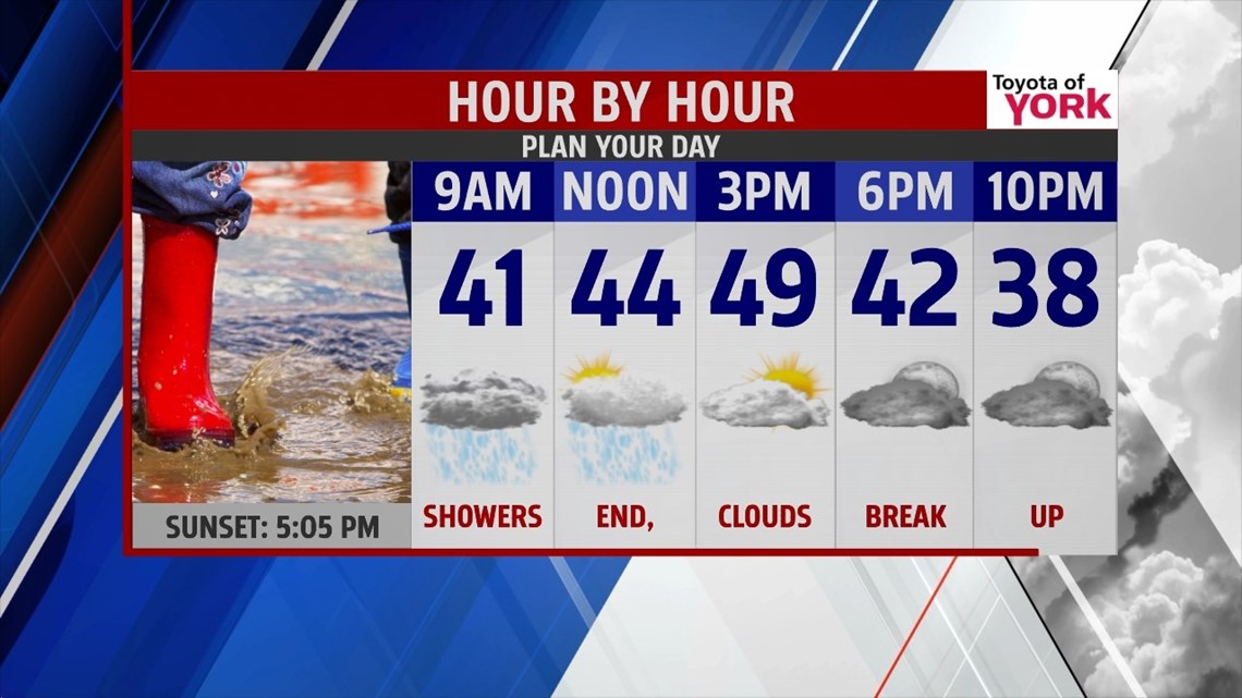
Over the next couple of days, a couple areas of low pressure moving through will slowly bring colder air back to the area. Tonight, showers will develop out ahead of a cold front that will swing in tomorrow afternoon. The showers will be light and scattered overnight. Lows will be mild in the upper 30s to near 40 with a southerly wind.

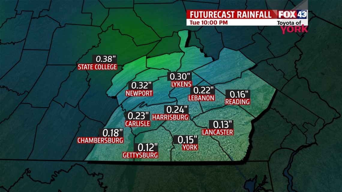
Tuesday, morning showers will end as the front moves east. I am only expecting about a .10” of an inch to maybe a 0.25” of an inch at most of rain which should have minimal impact on area creeks and streams. Sunshine will break through before it sets and temperatures will have no problem reaching the upper 40s to near 50. Winds will become westerly 5-10mph head of the front but shift behind it as it moves east and that will allow colder air to funnel in.

COLDER AIR RETURNS
The next front slides in Wednesday and may bring some snow showers. Highs will only make to the upper 30s. Behind the front an upper level trough deepens over the east coast pouring in colder air for Thursday. Skies will be partly cloudy and there could be a few flying flakes.
UNSETTLED PATTERN
Temperatures continue cold ending the week but above average. We’ll see another system arriving Friday into Saturday which will bring another shot of cold air for the weekend. This next system may also produce light snow showers but at this point, there is much discrepancy amongst the models to say how much or exactly when. We’ll keep you posted in the next few days.
MaryEllen Pann, Chief Meteorologist
Like me on Facebook: maryellenpannfox43
Follow me on Twitter: @MaryEllenFox43