
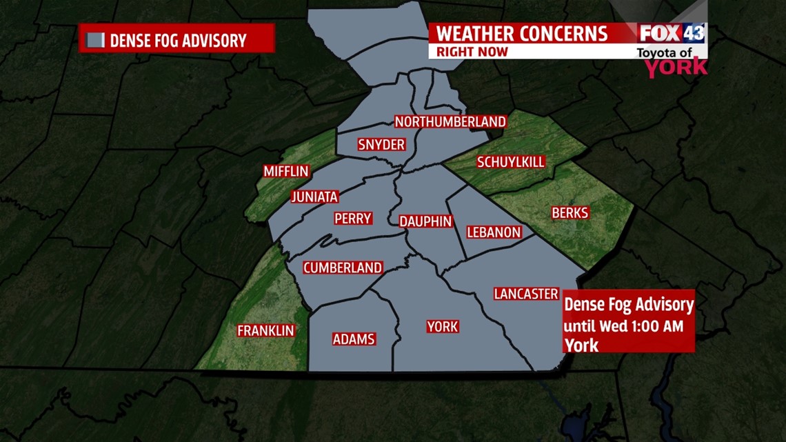
DENSE FOG ADVISORY IN EFFECT
Thick fog has formed as skies cleared and high pressure builds in at the surface. This has allowed temps to fall rapidly to the dewpoint. Visibility is down to a quarter of a mile or less and can change rapidly making driving hazardous. Please keep your low beams on if heading out and take it slow. The Advisory is in effect until 1am but some spots may remain foggy into the early morning commute. Clouds will start to increase by morning.

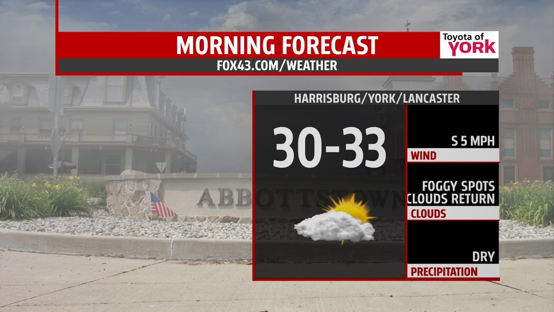
COLDER START TOMORROW
Clouds will break up for a period tonight before filling back in tomorrow. This has caused the formation of thick fog quickly across the area tonight. It will limit visibility for a period into the early morning hours. We’ll start the day with partly to mostly cloudy skies and dry for the morning commute. Lows will be colder in the low 30s.

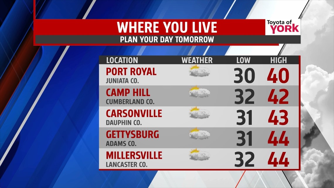
ONE MORE DAY WITH 40S
The next front slides in Wednesday and may bring an isolated rain or snow shower. There isn’t a lot of moisture with this next system but it will be followed by colder air. Highs will again reach the low to mid 40s. Behind the front an upper level trough deepens over the east coast pouring in colder air for Thursday. Skies will be partly cloudy and there could be a few flying flakes. Overnight lows will drop to the 20s with highs only in the mid to upper 30s Thursday.

UNSETTLED PATTERN
Temperatures continue cold ending the week but above average. We’ll see another system arriving Friday into Saturday which will bring another shot of even cold air for the weekend. This next system may also produce light snow showers but at this point, there is much discrepancy amongst the models to say how much or exactly when. We’ll keep you posted in the next few days.
MARTIN LUTHER KING JR DAY
Monday starts the week dry with highs in the upper 30s to near 40. Another system arrives for Tuesday which will bring rain and or snow showers and will certainly usher in colder air for the middle part of the week.
MaryEllen Pann, Chief Meteorologist
Like me on Facebook: maryellenpannfox43
Follow me on Twitter: @MaryEllenFox43