
TONIGHT
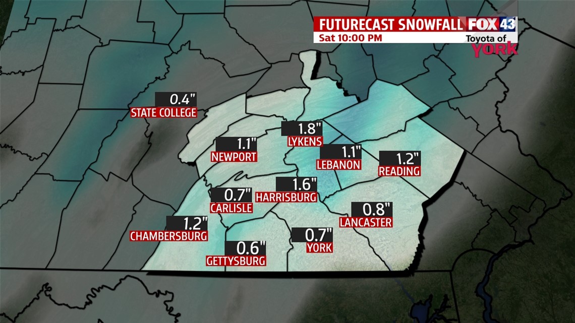
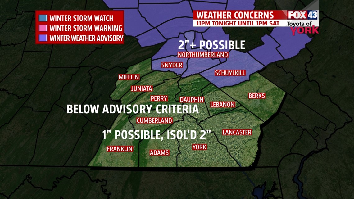
A strong disturbance moves through tonight and will enhance snowfall potential for the area. Snow should spread in after midnight but there could be isolated snow showers before then. Lows tonight will drop to the low to mid 20s. Snowfall amounts at this point expected to be about 1” with isolated 2” amounts which is below advisory criteria. Snow will fall overnight when most folks are off the roads and should be out of here by morning. This should be a minimal impact storm.


TOMORROW
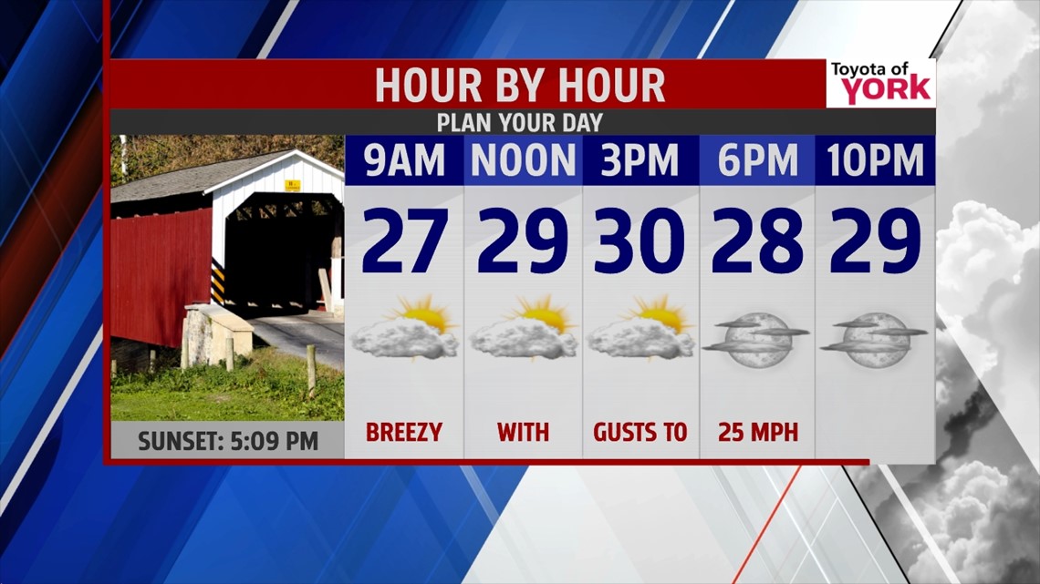
Morning flurries and clouds will break up lending to a mix of clouds and sunshine for a period during the day. Highs will be noticeably colder in the upper 20s to low 30s. Winds will pick up out of the west-northwest 10 to 20mph with gusts higher. Skies clear briefly towards evening but overnight will return as the next clipper system arrives Sunday morning.

SUNDAY
We’ll start the morning with light snow flurries and snow showers as a weak clipper passes to our south. Clouds breakup allowing for more sunshine which will help to boost our highs to the mid and upper 30s which is pretty seasonal.
NEXT WEEK VIEW
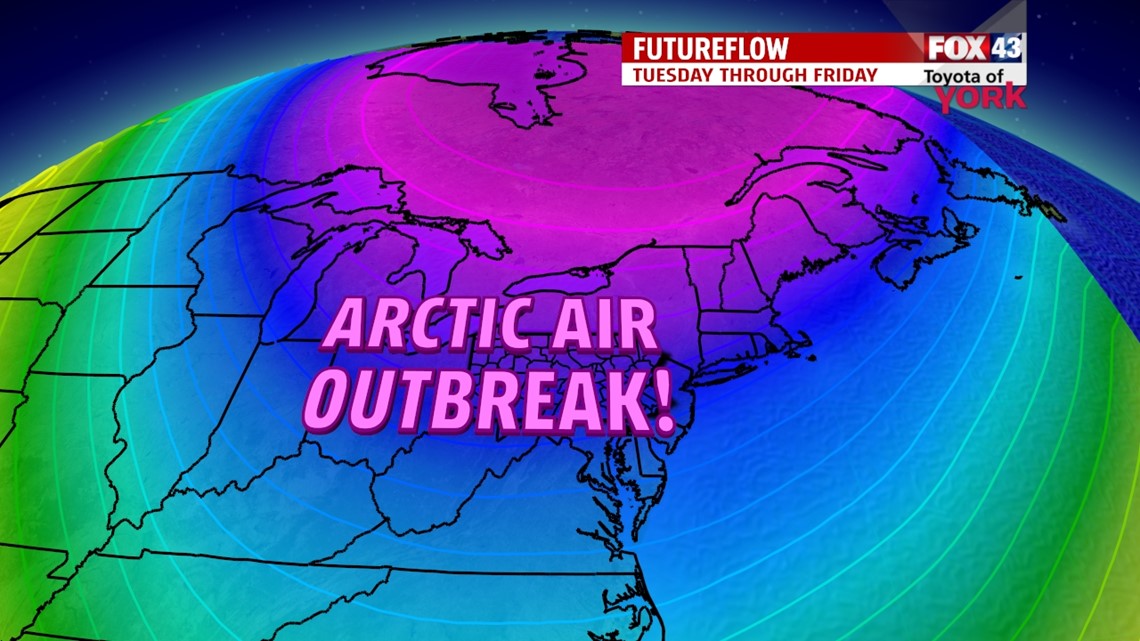
With several clippers rotating through every other day, they will reinforce colder air especially by next week. Monday a more potent system drops in, followed by another arctic blast of air which hangs around for several days. This means morning lows in the single digits and teens with highs from the upper teens to low 20s through Friday before we see temperatures rebound into next weekend.

MaryEllen Pann, Chief Meteorologist
Like me on Facebook: maryellenpannfox43
Follow me on Twitter: @MaryEllenFox43