

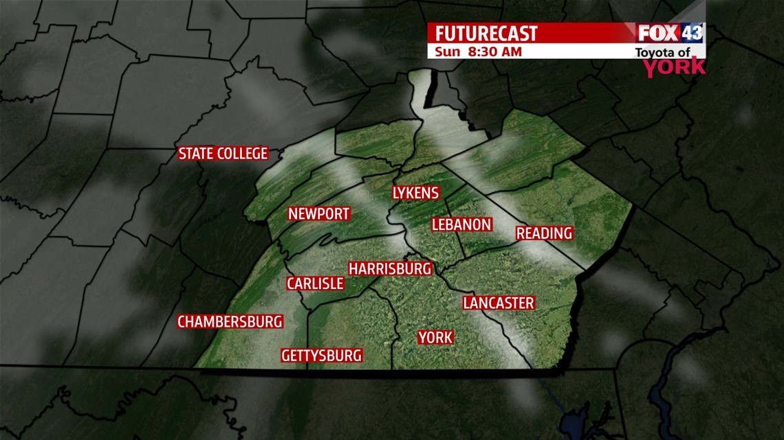
WEAKER SUNDAY NIGHT CLIPPER

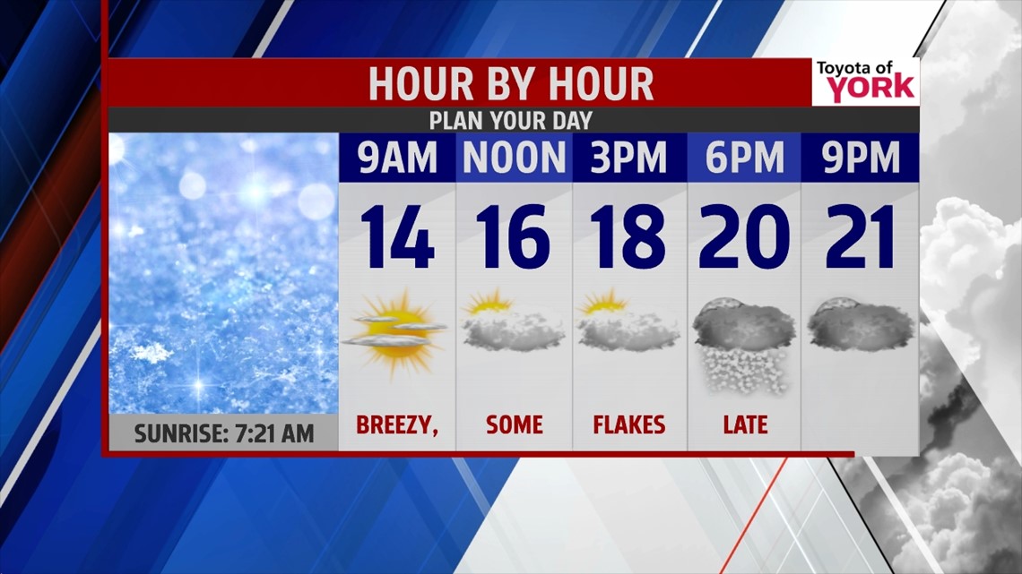
Scattered snow showers continue to push east, and they fade through the evening hours. Not much additional accumulations are expected, and they should remain under an inch. Skies clear through the overnight, and temperatures plunge into the lower teens and single digits. Some sunshine begins the day, but clouds increase during the afternoon ahead of yet another clipper. This one does not look as impressive as Saturday’s. A few flurries are likely late in the day, with a chance for some more snow showers overnight. Accumulations reach a half an inch at best, with most spots not even picking up a light coating. Highs are in the upper teens to lower 20s Sunday, and likely won’t occur until the evening.
YET ANOTHER ARCTIC BLAST
Monday a few flurries are leftover from the clipper during the morning, but skies partially clear a bit into the afternoon hours. A few afternoon flurries are possible in spots. Another arctic air mass comes rushing in! By Tuesday morning, the cold settles in, with lows possibly near 0 degrees! Afternoon highs are in the teens. The brutally cold air sticks around through Wednesday.
SLOWLY THAWING
We’ll have to wait until Thursday and Friday for some slight moderation to take place, but even then highs are still below seasonable averages! Friday, we’re at least close to, if not at, the freezing mark in many spots. There’s a chance for some flurries late Thursday through Thursday night. Skies clear out just in time for Friday. Saturday our next storm system heads this right, and right now it looks like a wintry mix changing over to rain.
Enjoy the rest of your weekend!
-Andrea Michaels