
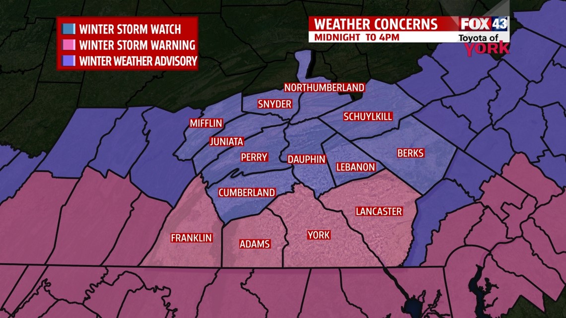
WINTER STORM WARNING goes into effect tonight at MIDNIGHT until 4PM tomorrow for York, Lancaster, Adams, Franklin and Lancaster and a WINTER WEATHER ADVISORY for the rest of the area.

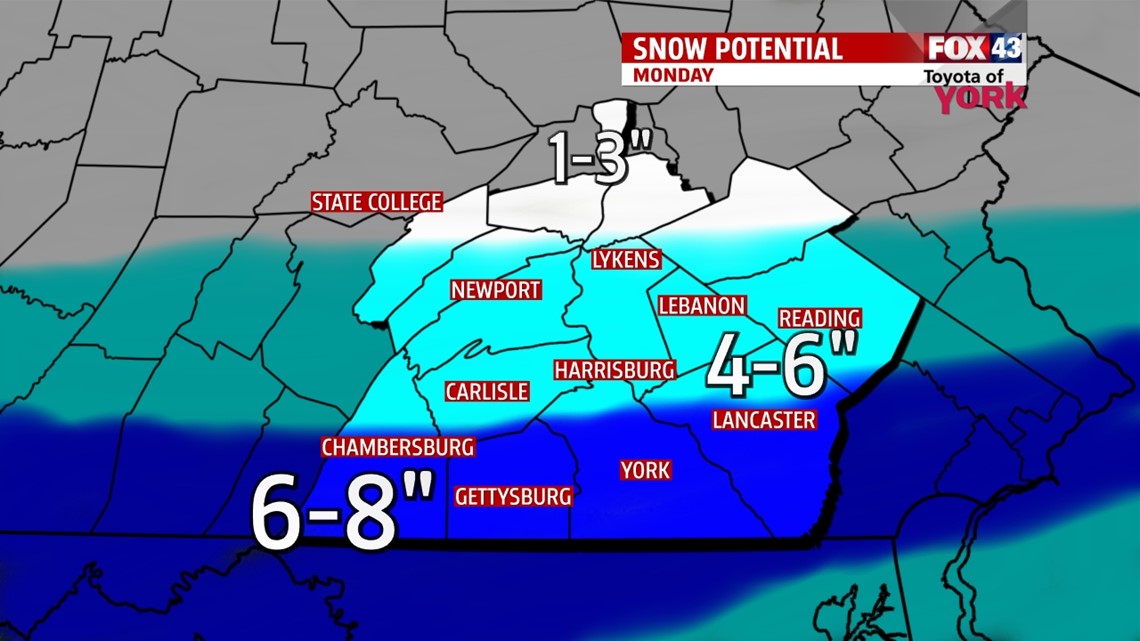
The counties in the warned area are expected to receive significantly more snow. Here is a breakdown of how much will fall and where.

TIMING: Rain possible after 11pm and will mix with sleet and snow for a period into the morning before changing over to all snow. Moderate to heavy snow may fall between 5am and 11am then taper off into the afternoon.
IMPACTS: Hazardous driving conditions during the morning commute. Expect slick roads and limited visibility.
TEMPS: Will range from 29 degrees to 33 degrees.
TONIGHT: A southern wave of low pressure lifting out of the southern plains will rapidly move through the Tennessee Valley, tracking through the Mid-Atlantic early tomorrow then off the coast Monday afternoon. Temps will be falling to the upper 20s to low 30s. With temps at or above freezing at the onset of the precipitation, it will start as rain mixing with sleet and snow then become snow in the morning.
TOMORROW: Snow will be heaviest during the morning hours until around noon time before letting up during the afternoon. Highs won’t budge much and should remain in the low 30s. Skies will clear and temps will plummet to the teens tomorrow night into Tuesday morning.
TUESDAY-WEDNESDAY: High pressure will temporarily provide a quiet day with highs in the low to mid 30s, but Tuesday night, the next system is raging towards us. Again we will be dealing with snow, freezing rain to start. Concern will be how long we see freezing rain before changing to rain. Heavy rain is expected on Wednesday once temps warm up. We could be dealing with an inch of rainfall so there is a concern with flooding and we will need to watch this very closely.
THURSDAY-FRIDAY: High pressure provides a couple of quiet days but it will be cold again with lows in the teens and highs only in the 20s.
WEEKEND OUTLOOK: February continues to start off very active with a storm every other day or two. The next storm of the week arrives Saturday and could bring us a wintry mix. We will certainly be bringing you the latest through the week.
MaryEllen Pann, Chief Meteorologist
Like me on Facebook: maryellenpannfox43
Follow me on Twitter: @MaryEllenFox43