
OVERVIEW: Our wicked ice and snow storm is pulling away from the region and we continue to dry out. High pressure brings a couple of quiet days as we end the week. Over the weekend, we are watching yet another storm that may pass close enough to bring another round of wintry precipitation. Right now, most of the models have it too far outside our area to have major impact on us but of course we will watch it closely and bring you the latest.
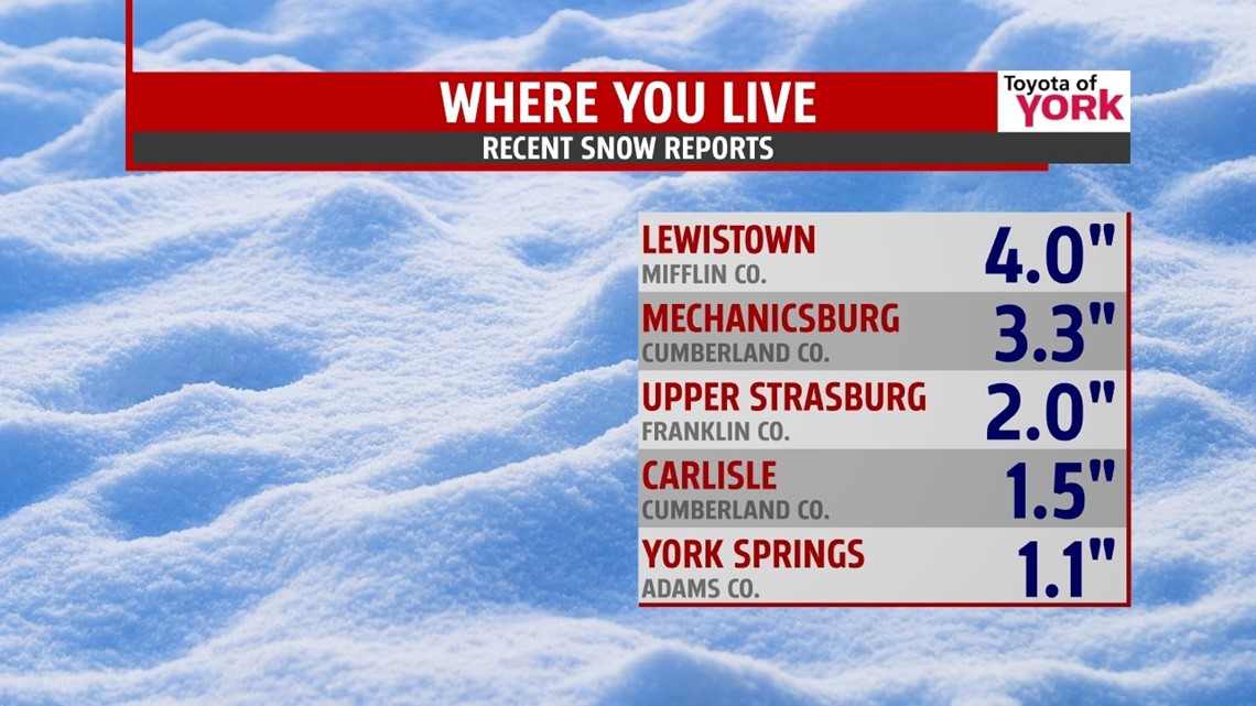
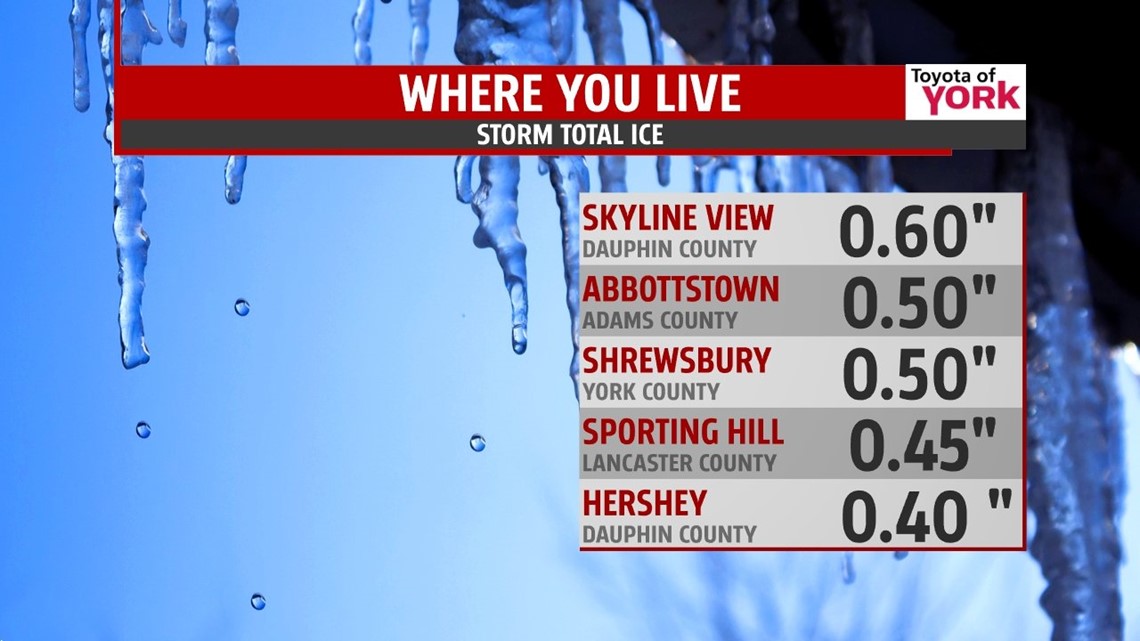
Here is a look at snow and ice totals from around the area.


TONIGHT: There may be a few flurries north and west of Harrisburg, otherwise, mostly cloudy with patchy fog. As high pressure builds in, the pressure gradient tightens leading to stronger winds and wind gusts.

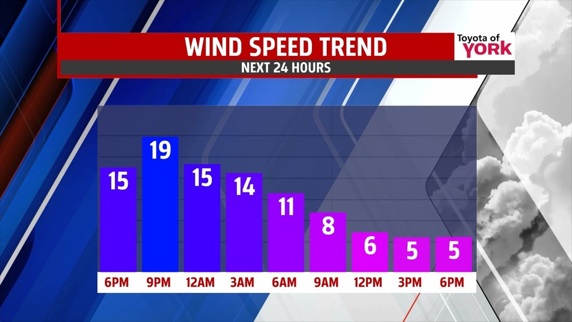
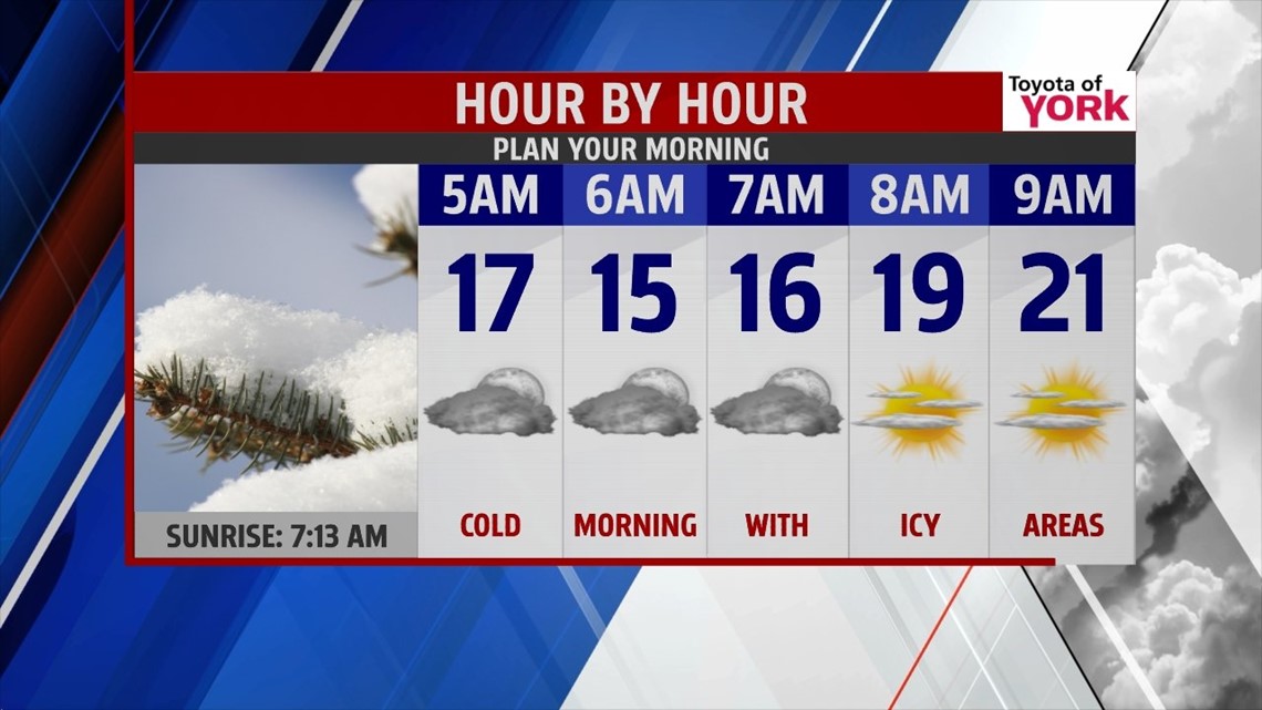
There remain numerous power outages and with ice still covering trees and power lines, the winds may bring more down causing concern for additional power outages. Temperatures will also get very cold dropping to the teens, which will lead to re-freeze of surfaces. An icy morning is expected.

THURSDAY-FRIDAY: Still a lot of moisture around for Thursday so we’ll call it partly sunny but dry with highs in the mid to upper 20s. Friday, expect more sunshine and less clouds, still cold, lows in the teens and highs in the middle to upper 20s.
WEEKEND OUTLOOK: Saturday looks to be mainly dry and still running cold with temperatures below average in the upper 20s. Models have been showing our next storm for Sunday but have backed off on it somewhat. Right now the storm doesn’t hug the coast like a few days ago but tracks further off the shoreline keeping the storm just far enough away that we may only see a few snow showers. We’ll certainly keep you posted as things change.
EARLY NEXT WEEK: It turns cold again as the upper level pattern goes from a zonal or westerly flow to a deepening trough which will allow colder Canadian air to spill down again. Lows will drop to the single digits with highs in the teens and 20s.
MaryEllen Pann, Chief Meteorologist
Like me on Facebook: maryellenpannfox43
Follow me on Twitter: @MaryEllenFox43